Google Premier Partner specialized in Location-Based Services.
The locations of the Regional Medical Centers in Blaricum and Hilversum experienced various navigation-related issues with Google Maps. When users navigated via Google Maps, they did not arrive at the correct location at Tergooi, leading to complaints and even dangerous situations for both patients/visitors and staff. This case study discusses the problems encountered at these locations and how they were resolved.
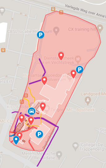
Due to the complete renovation of the hospital in Hilversum, the building outlines on the map were inaccurate, and locations such as the parking lot and pharmacy were misrepresented. Even the emergency department was positioned incorrectly, which is highly problematic, given the critical nature of accurate navigation from the outset. Additionally, adjustments had to be made to the roads around the roundabout and the area surrounding the new parking lot. For instance, the bike path adjacent to the Medical Center entrance was mistakenly identified as a roadway, contributing to hazardous situations.
We replaced the outdated building outlines and ensured that the POI markers were placed correctly. This ensures that patients arrive at the correct locations immediately. We also adjusted the road network to prevent navigation over roads that no longer exist. Additionally, we added the parking lot and included the bike path between Dopheidelaan and Kiss & Ride. Previously, this bike path was mistakenly shown as a roadway, leading to incorrect navigation instructions.


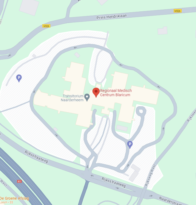
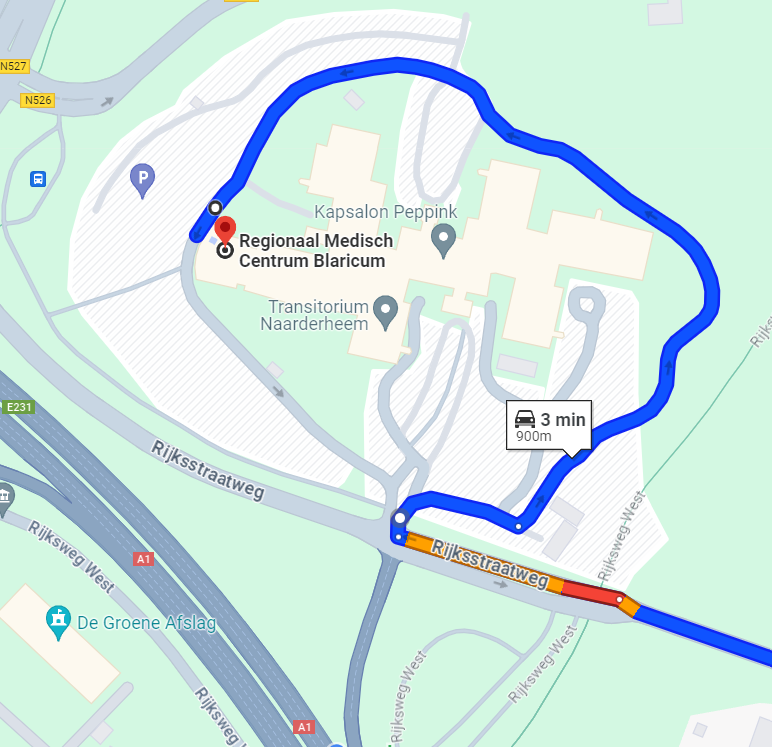
The hospital in Blaricum is situated within a small part of a large building, but Google Maps displayed the POI marker in the center of this building, leading patients to the wrong entrance.
We relocated the POI marker to the correct part of the building and added the road leading to the entrance. Now, patients are directed to the correct parking and entrance.
The case of the Regional Medical Centers in Blaricum and Hilversum highlights the challenges faced by healthcare facilities in using navigation tools such as Google Maps. Incorrect location data and misplaced markers caused problems for patients, visitors, and staff, resulting in potentially dangerous situations. Fortunately, these issues were addressed and resolved through precise adjustments to the maps, road network, and location indicators. These improvements ensure that users are now correctly directed to the right entrances and parking lots, significantly enhancing the navigation experience for all involved.
Would you like to be sure that your location is easy to find and access? Feel free to contact us via the contact form below. We are happy to think along with you and provide insight into potential improvements to your visibility and accessibility.
Your privacy settings
Manage Consent Preferences
Necessary
Analytics
Embedded Videos
Marketing
Facebook Advanced Matching
Facebook CAPI