Google Roads Management Insights & Localyse ODIQ
Harness the power of global mobility data
Every day, Google Maps collects an unprecedented amount of data on traffic flows and road infrastructure through millions of users. For governments and road authorities, it is becoming increasingly important to use this wealth of information not only for consumer navigation, but also to proactively shape smarter mobility policies.
Localyse plays a unique, dual role in this regard. On the one hand, we collaborate with governments to continuously enrich and improve Google’s digital maps. On the other hand, we act as a reseller to make this valuable, enriched mobility data accessible to the market.
With a market share of over 80%, Google provides the most reliable and detailed Floating Car Data (FCD) in the world. The practical impact of this is significant: 81% of drivers change their route while on the road based on this real-time traffic information. To properly analyze the dynamics of such traffic flows, two different solutions are available: our ready-to-use ODIQ software and Google’s new enterprise solution, Roads Management Insights.
ODIQ Localization: An accessible platform that requires no development
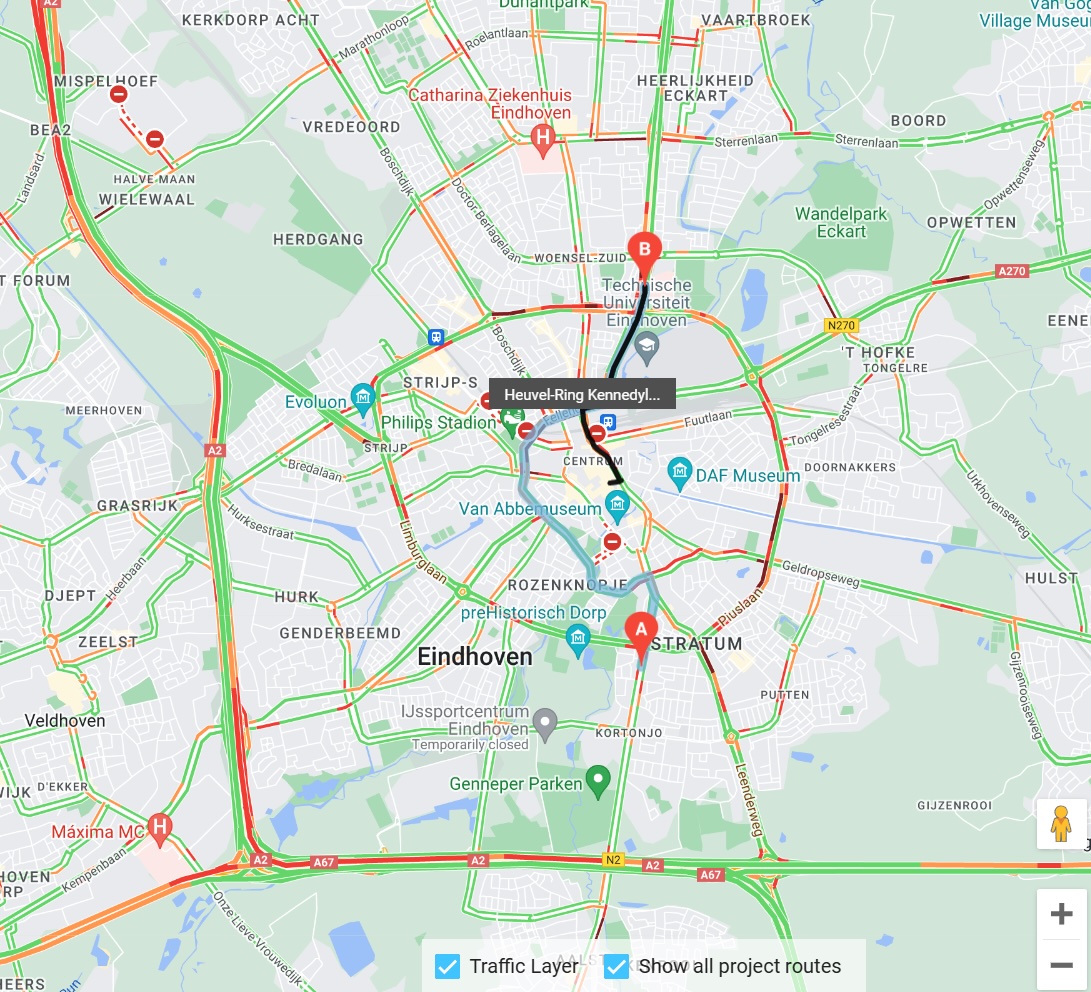
ODIQ is our proprietary cloud-based solution, designed to instantly make complex Google Maps traffic data visually accessible and actionable. Without the need to develop your own hardware or software, ODIQ provides insights into travel times, traffic congestion, and the impact of detours.
- Get started right away: No complicated setup is required. Simply place a source and destination pin on the map in the dashboard, and the data will start coming in right away.
- Building up data (measuring from the start): ODIQ functions, so to speak, as a data logger. From the moment you start the measurement (by placing the pins), you begin building your own history of travel time data. This allows you to measure current travel times, analyze through traffic, and identify bottlenecks throughout the duration of the measurement.
- Global coverage: Just like Google Maps, ODIQ works all over the world. It is an accessible and lightweight solution widely used by European smart cities, government agencies, and regional consulting firms.
- Transparent costs: This is an all-inclusive platform (including use of the viewer) with a starting price of €6,500 per year.

Google Roads Management Insights: The API toolkit for global scale
With Roads Management Insights (RMI), Google offers a powerful solution for analyzing large-scale mobility issues, such as traffic safety and emissions reduction. While ODIQ is a ready-to-use software product, RMI is a set of robust API building blocks. Access to the raw data must be purchased, after which users must handle the integration and visualization themselves.
Features of Roads Management Insights:
- Designed for Enterprise & Global Players: Specifically designed for multinational corporations, international consulting firms, or national governments that want to integrate raw data directly into their own large-scale GIS systems for complex infrastructure planning.
- Retroactive dates: Unlike ODIQ, where you build up data starting from the start date, RMI allows you to look directly into the past. You can immediately retrieve travel speeds and historical data patterns from, say, one or two years ago.
- Future roadmap: Google has major expansions planned for RMI, including traffic simulations, vehicle counting, pedestrian flow analysis, comprehensive incident data, and insights into the impact of air pollution.
- Investment (excluding development): RMI is a high-end data solution with a starting price of €36,000 per year. Please note: this price covers only the data license. Since no GIS viewer or ready-made interface is included, you will need to set aside a budget for your own development and integration costs.
Comparison chart
The best approach depends on internal technical capabilities, the need for historical data, and the available budget.
Localyse ODIQ
- Ready-to-use platform (SaaS)
- Municipalities, provinces, regional consulting firms
- Instant (Pins are placed, data starts coming in)
- Build it yourself (from the start of the measurement)
- Starting at €6,500 per year (all-inclusive)
Google Roads Management Insights
- API Data Building Blocks (DaaS)
- National governments, Global consultants, Enterprises
- Requires in-house software development / GIS integration
- Available immediately (with retroactive effect)
- Starting at €36,000 per year (+ your own development costs)
Discuss your project together?
Discover how Mobility Solutions can reduce your operational costs and provide your drivers, technicians, and end customers with an unparalleled, data-driven experience.