
Google Premier Partner specialized in Location-Based Services.
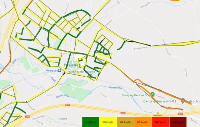
In the municipality of Meerssen, many 30 km/h zones were incorrectly registered as 50 km/h zones in Google Maps. This led to unwanted cut-through traffic and unsafe situations. Proactively adjusting Google Maps data proved to be the key to a safer living environment. The municipality of Meerssen took the lead and engaged Localyse to keep its digital map up to date and restore traffic safety.
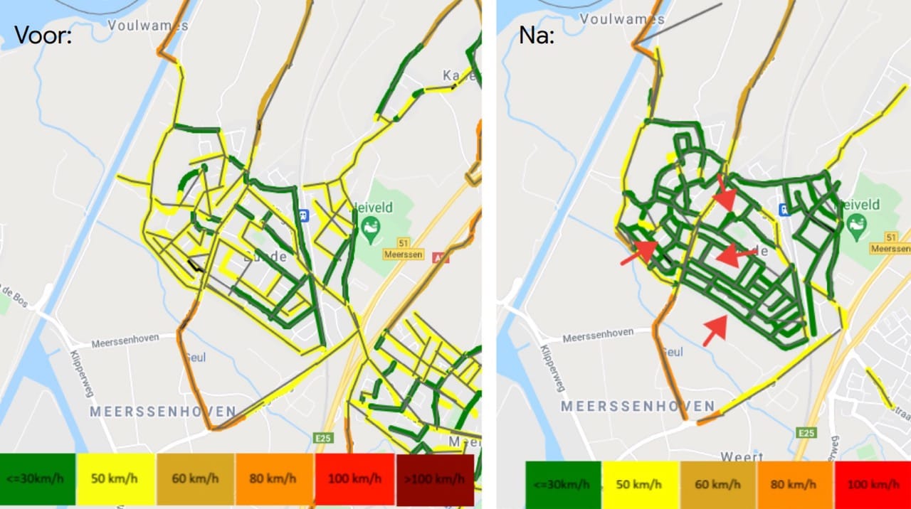
Everyone relies on navigation apps. They determine the fastest route based on data, including the maximum allowed speed. The problem arises when this traffic data is outdated. In Meerssen, this was the core of the challenge: the physical reality of carefully designed 30 km/h zones did not match the digital reality in Google Maps, where these roads were still listed as 50 km/h.
Correcting these kinds of map errors is complex. The assumption that service providers will automatically update this information is often incorrect. Without proactive traffic data management, an unsafe situation can persist for an unnecessarily long time.
The impact of a simple, incorrect speed registration is significant and directly felt by residents:
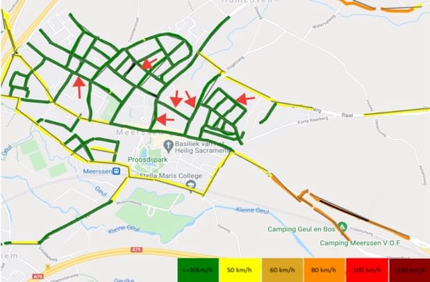
Waiting was not an option. The municipality of Meerssen opted for a targeted approach to have the data in Google Maps, Waze, and TomTom corrected.
As a Google Premier Partner, Localyse has the expertise and direct channels to perform this efficiently. For Meerssen, the solution lay in their “Improve Maps” service:
By correcting the maximum speeds in the most important navigation systems, the municipality of Meerssen achieved tangible results:
“Thanks to Localyse, commuters no longer travel through Meerssen and traffic safety has improved.”
Would you like to be sure that your location is easy to find and access? Feel free to contact us via the contact form below. We are happy to think along with you and provide insight into potential improvements to your visibility and accessibility.
Your privacy settings
Manage Consent Preferences
Necessary
Analytics
Embedded Videos
Marketing
Facebook Advanced Matching
Facebook CAPI