Google Premier Partner specialized in Location-Based Services.
The municipality of Eindhoven improves the digital findability of P+R Genneper Parken with smart mobility solutions by partnering with Localyse.
The digital findability of P+R Genneper Parken in Eindhoven left much to be desired. The location was not displayed properly in the popular navigation app Google Maps, leading to incorrect routes, missing Points of Interest (POIs), incorrect speeds and an unclear map display. And while a lot had been invested in this new P+R location, it was a shame that it was not being used enough.
P+R Genneper Parken is an attractive alternative for visitors to Eindhoven. Not only are parking costs lower, the travel time to the center of Eindhoven is also shorter. The location also offers access to a modern mobility hub, allowing visitors to easily transfer to a shared bicycle or shared scooter towards the city center after parking.
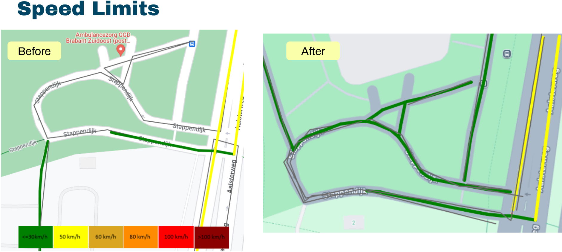
Yet cycling routes and walking routes were initially displayed illogically. This was because no digital cycling infrastructure was available in the map data. This has now been resolved with the help of Localyse and targeted map optimization, so that visitors can now find their way effortlessly and efficiently to and from P+R Genneper Parken.
A survey among 2,600 respondents showed that Google Maps and to a lesser extent websites were mainly used for navigation to Limburg (including the target groups of Toverland and Arcen), within an average radius of 100 km. Waze and Apple Maps were only used by 1% of respondents. This was one of the reasons to invest in improving the commercial map provider. In this way you can influence travel behavior.
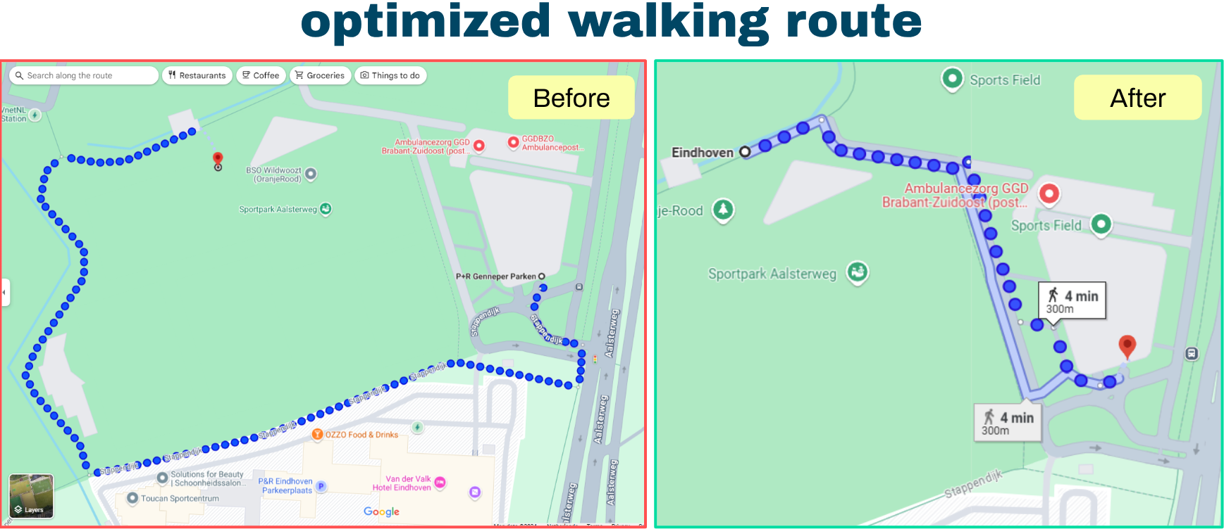
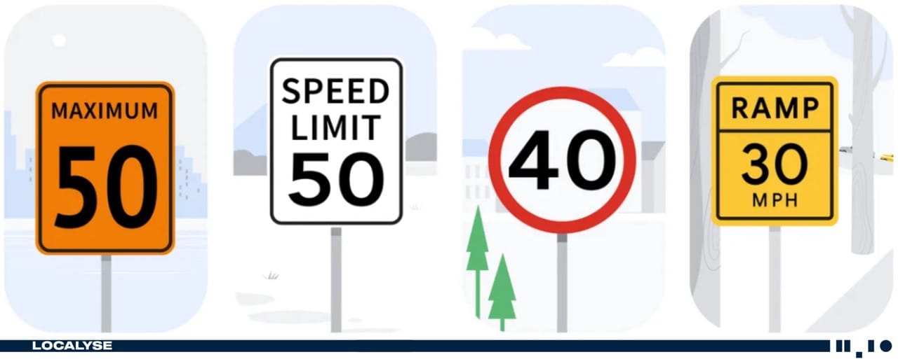
The solution consisted of synchronizing digital map layers and route networks with reality. This included adjusting routes, adding and changing roads, correcting POIs, adding building contours, and entering speed limits in Google Maps.
This project shows the impact of accurate map data on user experience. Thanks to the above improvements, P+R Genneper Parken is now more visible to anyone who searches for terms such as “Parking Eindhoven”. Are there similar problems in your municipality? Schedule a meeting immediately.
Would you like to be sure that your location is easy to find and access? Feel free to contact us via the contact form below. We are happy to think along with you and provide insight into potential improvements to your visibility and accessibility.
Your privacy settings
Manage Consent Preferences
Necessary
Analytics
Embedded Videos
Marketing
Facebook Advanced Matching
Facebook CAPI