Google Premier Partner specialized in Location-Based Services.
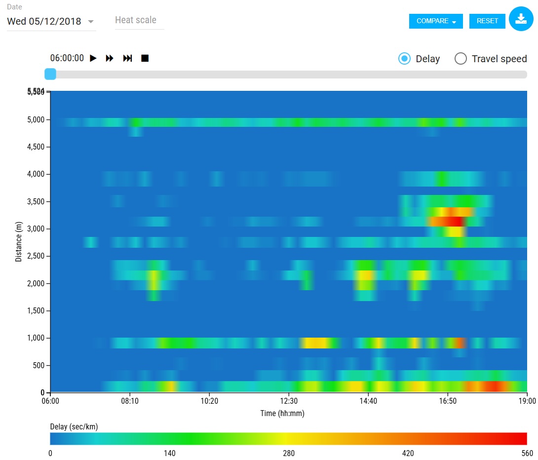
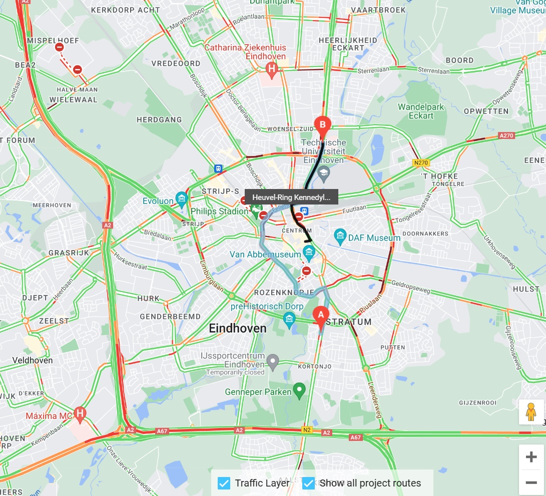
Rijkswaterstaat Traffic and Water Management (RWS) chose for a collaboration with our Google Maps tool ‘ODIQ’. The aim is to get a clearer picture of how traffic is evolving in terms of travel times, delays and speed.
This way RWS is able to serve road users even better, minimize delays and make the Dutch national highways safer.
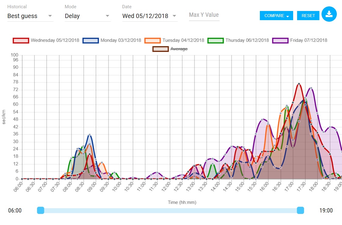
RWS always want to improve the analysis. In their search for additional data sources, they chose ODIQ, a Google Maps based platform. The goal: get an even better and clearer view of the traffic situation at a specific location at any given time in terms of travel times, delays and speeds. This allows RWS to improve its services to road users in the Netherlands.
The traffic management center regulates traffic on all national highways in the region. The traffic center also handles incident reports on provincial roads in the region. The traffic center also operates and monitors tunnels and bridges from a distance.
RWS plays a leading role in road works, congestion and traffic incidents. Amongst others, the traffic management center can close roads, divert traffic and inform road users via the dynamic route information panels. Interested in objective data on the traffic situation in your city? Contact Jeffrey Benning today to discuss the possibilities.
Would you like to be sure that your location is easy to find and access? Feel free to contact us via the contact form below. We are happy to think along with you and provide insight into potential improvements to your visibility and accessibility.
Your privacy settings
Manage Consent Preferences
Necessary
Analytics
Embedded Videos
Marketing
Facebook Advanced Matching
Facebook CAPI