
As a Google Maps Premier Partner, Localyse is sharing major news today about a groundbreaking update within the Google Maps Platform. The way we use location data and reach our destinations is about to change fundamentally. Where we used to talk about finding a standard address, we are now talking about mastering the so-called ‘last meter’. And the best news for developers and logistics planners? These powerful new features for hyperlocal precision are being added to the existing Geocoding API at no extra cost.
Below, you can read our analysis of this “next-generation” geocoding and how we plan to combine it with smart parking data in the future for ultimate route optimization.
The ‘Last Meter’ Revolution: Hyperlocal Precision
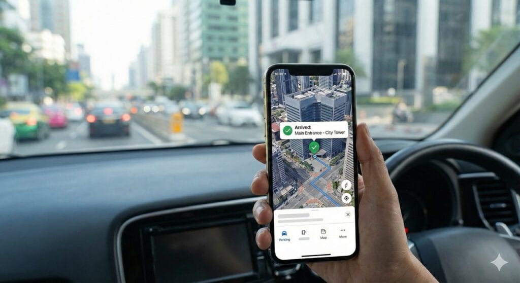
In practice, the biggest challenge for delivery services, mobility platforms, and logistics companies isn’t the journey from A to B, but those notorious last few meters. A standard address on paper is rarely the exact endpoint.
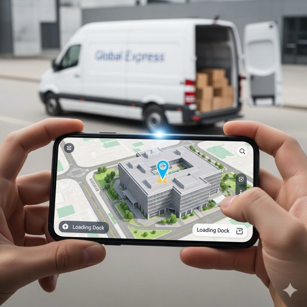
With the introduction of Rich Hyperlocal Destination Details, Google Maps enables developers to look much further than just a street name and house number.
What’s New in the Geocoding API?
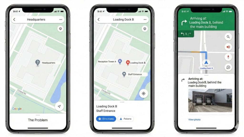
- Sub-locations and Specific Entrances: A large office complex, shopping mall, or hospital often has multiple entrances. With the updated location data, users can now specifically select ‘Tower 4’, ‘Loading Dock B’, or ‘North Entrance’. This prevents a driver or visitor from ending up on the wrong side of a building.
- Seamless Flow to Navigation: What makes this update unique is the deep integration. The details you select in the API are passed directly and flawlessly to the Navigation SDK via NavigationPointTokens. The driver sees the exact right spot on their screen, without any noise or confusion.
- Contextual Understanding: Thanks to new Address Descriptors, locations gain much more context. Instead of simply delivering GPS coordinates, the system now also understands recognizable landmarks in the area. This makes it much more intuitive for users to verify their destination (e.g., “next to the station” or “at the main entrance of the park”).
Why This Update is a Gamechanger for Your Platform
At Localyse, we know that operational efficiency is directly linked to data quality. The benefits of this free upgrade within the Google Maps Platform are evident:
- Fewer failed deliveries: No more unnecessary searching for the right front door or loading dock; navigation stops at the exact right location.
- Better user experience: Customers can pinpoint a location in your app or website with much more confidence, leading to demonstrably higher conversions.
- Direct cost savings: Every minute a driver spends looking for an entrance costs money and fuel. By optimizing the last meter, you instantly save on operational costs.
The Future: From the Last Meter to the Last Millimeters
We aren’t just seeing this shift toward the exact final destination at Google. Recent research from the prestigious MIT (Massachusetts Institute of Technology) highlights a similar bottleneck: parking-aware navigation.
They calculated that smart navigation, which not only finds the final destination but also calculates where the probability of finding a vacant parking spot is highest, can cut travel time in busy cities by up to 35 minutes. This prevents unnecessary cruising, which saves frustration and drastically reduces CO2 emissions. Where Google Maps ensures you blindly find the right entrance (the last meter), smart parking navigation ensures you can actually park your vehicle once you get there (the last millimeters).
From Theory to Practice: Our Partnership with SHPV
At Localyse, we are already making this theory a reality. The current parking market is highly fragmented: there is a proliferation of websites showing parking rates and a rapidly growing supply of alternative parking locations via platforms like ParkBee. For developers, it is a challenge to see the forest for the trees.
That is why we are working closely with SHPV (Servicehuis Parkeer- en Verblijfsrechten). Together, we are exploring how to make this massive stream of parking data more relevant and uniform. Our goal is to present all current parking options and rates in a standardized way and intelligently connect them to the Google Maps Platform.
By combining the hyperlocal precision of Google’s updated Geocoding API with up-to-date, uniform parking data, we are creating the ultimate routing experience. Soon, you will not only know exactly which side of the building you need to be on, but also where you can park your vehicle the fastest, cheapest, and most efficiently.
Claim Your ‘Last Meter’ with Localyse
Because these new Google Maps features have been added to the standard Geocoding API free of charge, you can often start benefiting from this richer, hyperlocal data with minimal technical adjustments.
Curious about how you can solve the ‘last meter’ and the parking challenge for your customers and drivers? Feel free to reach out. We would love to brainstorm the smartest, most efficient implementation for your specific use-case.
Sources:


