Google Premier Partner specialized in Location-Based Services.

BAM Infra – Improved traffic flow

BAM Infra is the premier partner for infrastructure connections in the Netherlands. They offer innovative solutions and do so in their own unique way. Slightly differently. Just a little smarter. And always safely and sustainably. That is what they stand for. That is what they strive for. BAM Infra Nederland is a subsidiary of Royal BAM Group, a successful European construction group, which unites operating companies in the two business lines Construction & Real Estate and Infrastructure as well as in the area of public–private partnerships. BAM is listed on Euronext Amsterdam.

Challenge

Until recently, induction loops in the asphalt or roadside systems were necessary to measure the flow of traffic. In the current digital age, however, many more sources are available, such as data from moving vehicles – an innovation that BAM Infra uses. After a summer of non-stop work, BAM Infra finalized a complete renovation of the Gein Bridge in Driemond in the autumn of 2017. The province of Noord-Holland wanted to replace the bridge because it was ‘in a very bad condition’. At the same time, the crossing at Driemond was improved too. The purpose of all this work was to improve the safety and traffic flow of the road.

Zonder titel 800 x 630 px 5

Benefits

At Driemond, initial measurements of the new situation show significantly improved traffic flows. The lines in the figure show the current time losses (red) compared with the average time losses for the past years (blue). When it comes to tenders or visualization of the effects of temporary traffic systems – a speed reduction or changed road situation for example – BAM also monitors the traffic situation through the use of floating car data from ODIQ.

This development is in line with the broader vision of BAM Infra in which data plays a central role. The same applies to the infrastructure. Thanks to sensors, cameras, public data and the deployment of satellites, among other things, we are learning ever more about how infrastructure is used. And how this information can be used to create added value for users, managers and the local area.

* floating car data: Floating car data, at its most basic level, consists of GPS data from smartphones and apps such as the Google Maps app on your smartphone. This ‘data’ contains information about aspects such as travel times and speeds.

Zonder titel 800 x 630 px 6

Let's discuss your project

Looking for a way to make better decisions about your business’s location-based strategies? Look no further than Localyse!

Email

Phone

🇳🇱 +31 (0)172 25 55 00 

How Brussels used ODIQ as an alternative to traffic cameras

Brussels is the capital of Belgium and Europe. With 1.2 million inhabitants it counts as one of Belgium’s biggest cities. During the pandemic, Brussels used the reduced traffic in 2020 to accelerate their mobility plans. To follow up on the adjustments in real-time and historically, Brussels Mobility contacted Localyse.

logo NL

Localyse monitors all major access routes in Brussels

Mobiris, the dispatching center of Brussels Mobility, has about 500 cameras to monitor more than 350 km of roads in the Brussels-Capital Region, ‘one might think that’s plenty’ but in reality it’s far from enough. That’s why Mobiris, was looking for an addition/alternative to cameras. Localyse, introduced Brussels Mobility to ODIQ which uses Google Maps’ Floating Car Data, this is worldwide GPS data from smartphones on which Google Maps is installed… an inexhaustible, representative data source.

A versatile tool

ODIQ can be used for carrying out traffic analyses before a decision or intervention and after. Furthermore, the tool allows to detect bottlenecks intersection by intersection, and find out the reason for them: whether it is a wrongly adjusted traffic light, an illogical right of way or a bicycle lane that should be moved with ODIQ, it all becomes clear.

Brecht Debusschere

Traffic situation monitoring team lead

At trade fair we saw a presentation on ODIQ, and it seemed to be the ideal tool for gaining quick and easy insight into traffic situations by mapping traffic flow in real time.

Let's discuss your project

Looking for a way to make better decisions about your business’s location-based strategies? Look no further than Localyse!

Email

Phone

🇳🇱 +31 (0)172 25 55 00 

Lantis: real-time traffic data during major construction in Antwerp

Lantis realizes complex mobility projects in the Antwerp region. They build sustainable and functional connections for all types of road users, this enables the Antwerp city and region to flourish.

lantisnieuwsartikelnaam

Traffic control in Antwerp during major road works

Being stuck in traffic… a massive source of frustration, for thousands of people it’s the day-to-day reality in and around Antwerp. The Oosterweel project will be the solution to this bottleneck and is going to make the traffic flow, safer and more smooth. Next to improving mobility, the Oosterweel project will also contribute in making the Antwerp region more livable.

Managing traffic congestion

Before this project is completed, road works will continue for a couple of years. The challenge: to limit congestion as much as possible and guarantee safety. A lot of planning will be done to determine which alternative roads should be foreseen at any given time and where cut-through traffic might occur. To get an overview on this, Localyse, uses ODIQ to continuously analyse 250km of traffic. More information about this project can be found in the full use case below.

Let's discuss your project

Looking for a way to make better decisions about your business’s location-based strategies? Look no further than Localyse!

Email

Phone

🇳🇱 +31 (0)172 25 55 00 

Evaluation of Sint-Niklaas’ circulation plan with Floating Car Data

Sint-Niklaas is a continuously innovating Flemish city with over 80 000 inhabitants. Besides adding more green to the city square, numerous other initiatives are being worked on to make the city more livable.

Unknown 1

Floating Car Data put to work

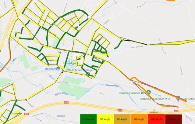
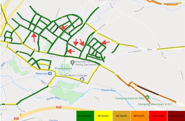
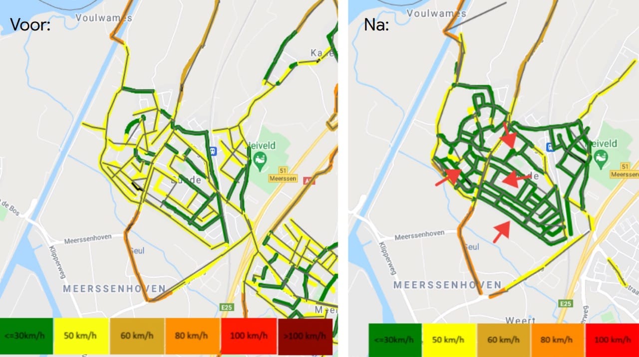
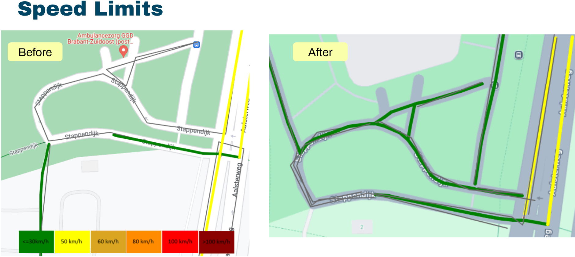
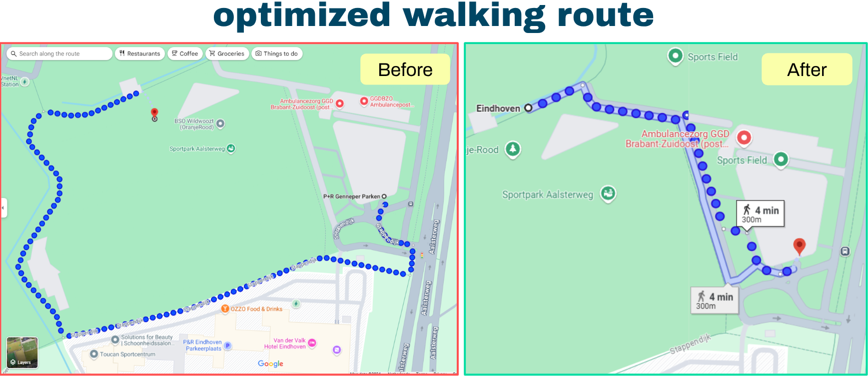
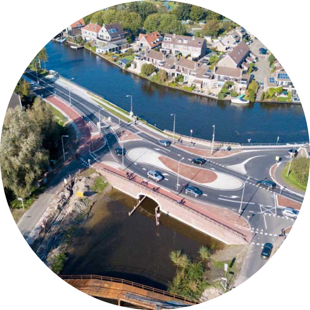
The city of Sint-Niklaas received some complaints about cut-through traffic and excessive speed in a certain residential area. To deal with these complaints, Sint-Niklaas made some infrastructural changes to lessen the impact of the problems.

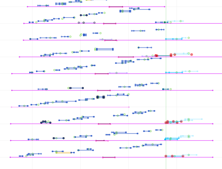
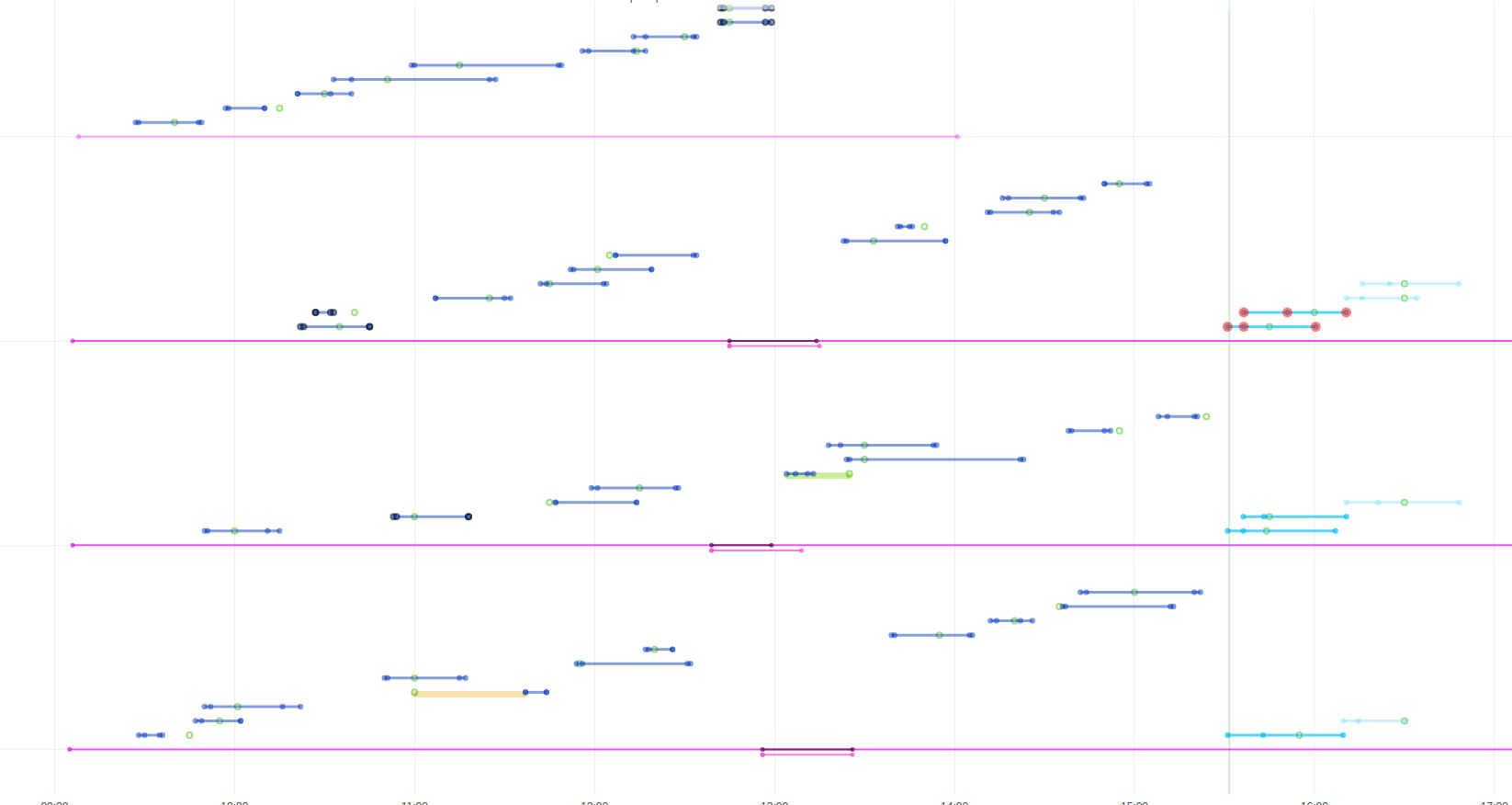
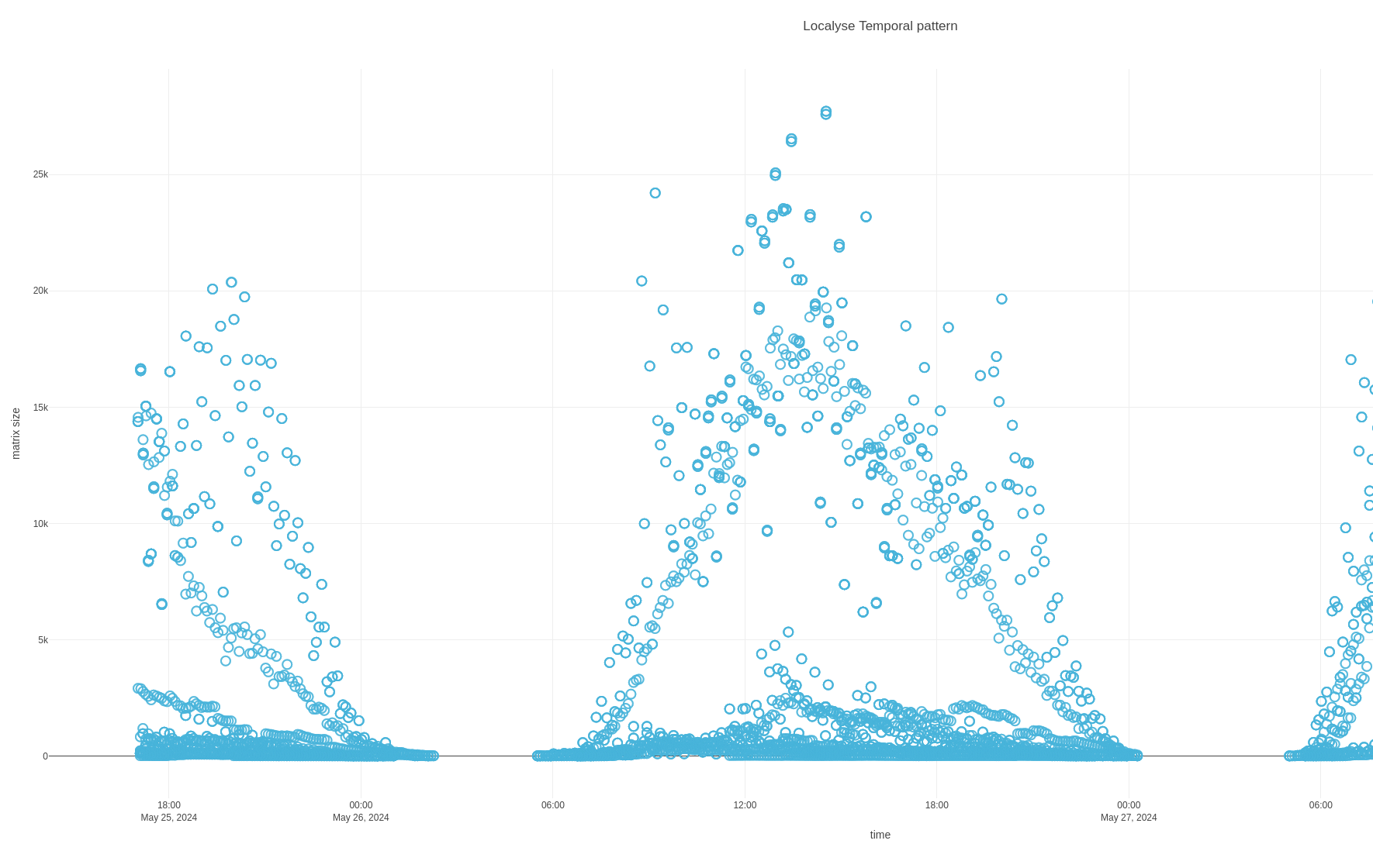
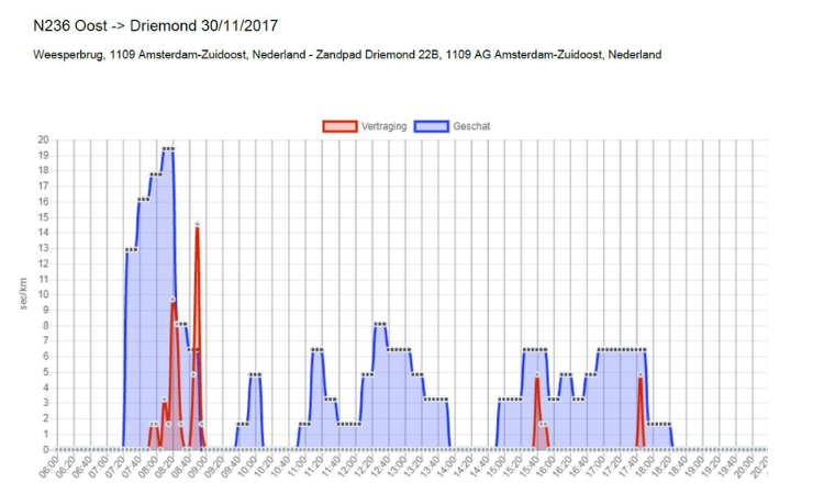
After changes were made the city council wanted to assess the impact, that’s where Localyse came into play. We provided insights by combining Floating Car Data and classic traffic counts.

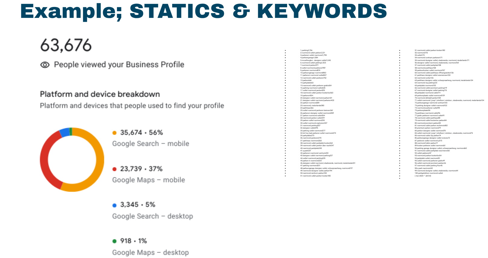
These are some insights we gathered:

Thanks to our insights the city of Sint-Niklaas was able to conduct a valuable assessment of their infrastructural changes. More about this project can be read in the complete use case below.

Let's discuss your project

Looking for a way to make better decisions about your business’s location-based strategies? Look no further than Localyse!

Email

Phone

🇳🇱 +31 (0)172 25 55 00 

Sint-Niklaas: from a congested town square to a green oasis

Sint-Niklaas is a modern city in the East of Flanders, Belgium. With more than 78.000 inhabitants it counts as the second biggest city of the region. Next to that, Sint-Niklaas features Belgium’s biggest square with 3.19 hectares.

Unknown 1

Transforming Sint-Niklaas

Infrastructural improvements will start in 2023 to transform Niklaas’s square (Grote Markt) into a beautiful, welcoming location. In order to achieve this, a lot of trees will be planted and a traffic filter will be installed on the access routes toward the town square. As a result, the car park under the town square will only be accessible from the north of the city.

Els De Deken

Mobility Consultant

This traffic analysis has enabled us to make a correct estimate of the necessary parking area on the north side of the town square. Research made it clear that there is only a capacity problem at rush hour.

Optimal results through various data sources

To understand the impact of the proposed measure, Sint-Niklaas asked Localyse to get an overview of the current situation, before and during Covid-19. To gather optimal data we combined a number of data sources:

Let's discuss your project

Looking for a way to make better decisions about your business’s location-based strategies? Look no further than Localyse!

Email

Phone

🇳🇱 +31 (0)172 25 55 00