
The importance of sustainability within urban landscapes cannot be overstressed. Leveraging Google Earth Engine, we now empower policymakers with visual insights into the green quotient of their Smart Cities. Informed decisions lead to superior green strategies.
Understanding Client Needs
“Sustainability” is the hallmark of our future-ready Smart Cities.
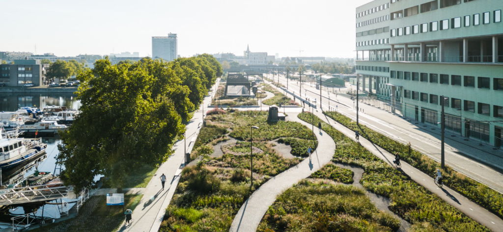
Urban green spaces serve as the lungs of our cities, playing a pivotal role in influencing temperatures. Consequently, they significantly impact the health and well-being of city dwellers.
Today, cities across the globe are intensifying efforts to expand green zones, combat the ill-effects of climate change, and elevate the urban living experience.
Given these endeavors, there’s a pressing demand for tools that not only track the growth and decline of green spaces but also identify vulnerable zones, thereby facilitating targeted and data-driven green initiatives. This tool should also allow comparisons with green growth metrics of other cities.
Our Innovative Solution
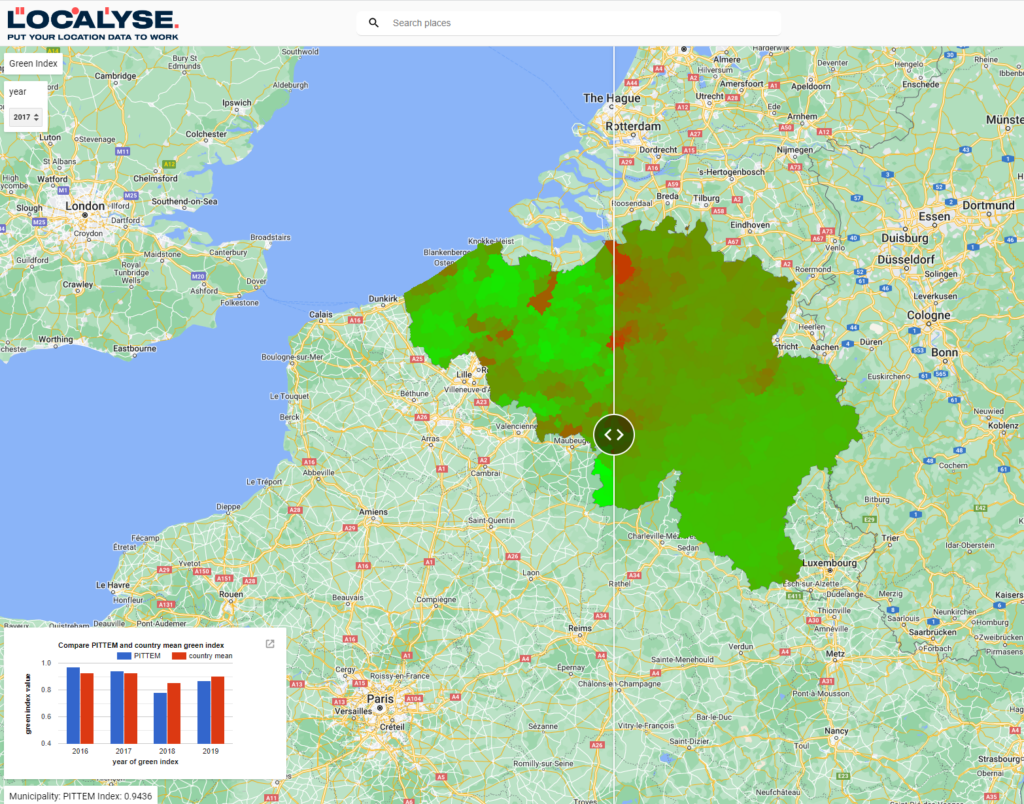
Localyse introduces the Green Index tool – a marriage of remote sensing data and cutting-edge technologies, underpinned by satellite imagery from Google Earth Engine. Utilizing satellite data, we gauge the Green Index using the NDVI (a measure for vegetation health and density) at both high resolutions and extensive temporal spans. The brilliance of Google Earth Engine ensures seamless calculations and precise visualizations. Its user-friendly interface, featuring interactive sliders and informative pop-ups, offers a comprehensive overview of green metrics within any city or municipality.
Thanks to Google Earth Engine and our Geo Green Index, deciphering complex satellite datasets has never been easier. Continual updates mean you’re always viewing the most recent imagery. Witness the evolving green landscape with unmatched clarity.
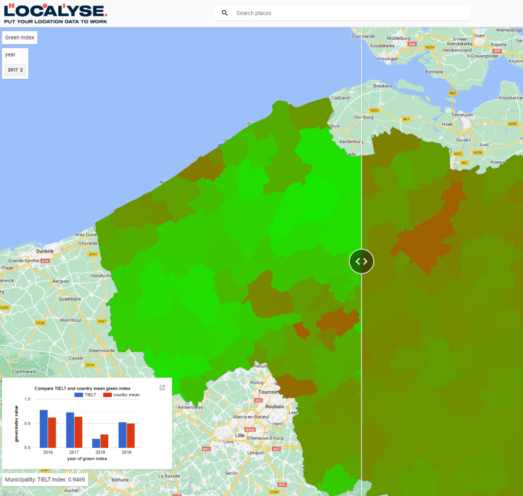
Localyse got to work developing a remote sensing tool for decision makers to monitor the amount of green space in their own municipality or city to ensure a more targeted approach and more efficient use of budget. This tool not only visualizes the extent of green spaces within a city but also ensures resource optimization by tracking these metrics over years.
Together, let’s pave the way to a greener tomorrow! Now is the time to harness the power of remote sensing for a brighter, greener urban future!


