

During a recent broadcast of Villa VdB on NPO Radio 1, Jeffrey Benning was once again a guest. One key development took center stage: how navigation is shifting from “roughly there” to the exact front door.
Where navigation used to end with a dotted arc pointing toward an address, we are now witnessing a fundamental transformation. With Live View navigation and hyperlocal location data, the route is extended from:
- the highway
- to the parking facility
- to the correct building
- all the way to the precise entrance
This is not a cosmetic upgrade, but a structural optimization of the “last meter.”
From Dotted Line to Exact Entrance
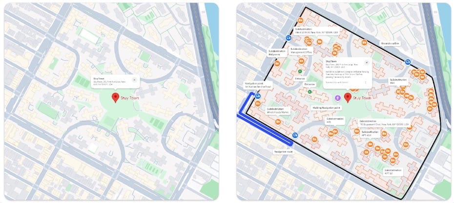
On business parks, hospital campuses, or large office complexes, the same friction often occurs: you have “arrived,” but you are not actually there yet.
Consider:
- multiple towers under one address
- different entrances
- separate loading docks
- visitor versus supplier entrances
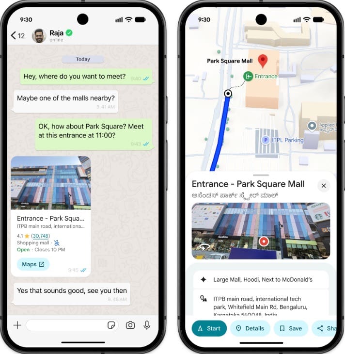
Live View leverages camera-based visualization (AR) and high-precision positioning to visually guide users to the correct entrance. No more guesswork. No more circling the building. No more phone calls saying, “I’m here, but where exactly should I be?”
Navigation now aligns with physical reality.
Travel Time Is Becoming Increasingly Precise
One clear takeaway from the radio conversation: travel time predictions are improving not only in terms of traffic conditions, but also in endpoint precision.
Previously:
- Route to the address
- Search on your own
Now:
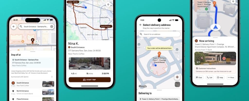
- Route to the parking location
- Walking route to the correct entrance
- Contextual visual landmarks
The result:
- Less search traffic
- Reduced frustration
- Lower fuel consumption
- Decreased operational costs
- More accurate arrival times
For logistics operators, mobility platforms, and field service organizations, this translates directly into measurable efficiency gains.
The Link with the “Last Meter”
This broadcast closely aligns with our recent analysis of the latest update within the Google Maps Platform: optimization of the “last meter” through the renewed Geocoding API.
With the introduction of:
- Rich Hyperlocal Destination Details
- Sub-locations and specific entrances
- NavigationPointTokens
- Address Descriptors
Developers can now precisely determine where a route should end.
Live View functions as the visual layer on top of this technical innovation. The API ensures data precision; Live View ensures user experience.
Read Jeffrey’s blog with his in-depth analysis of the “Last Meter” here.
At Localyse, we combine hyperlocal Google data with intelligent parking data to create a fully optimized route — from point of departure to actual access.
Listen Back to Jeffrey
Curious about the full conversation?
Jeffrey can be heard between 1:08:54 and 1:14:30 in the Villa VdB broadcast on NPO Radio 1.
What Could This Mean for Your Organization?
Interested in exploring the impact for your organization?
Contact Localyse for a concrete use-case analysis or a technical deep dive. Schedule a session with our team and discover how to structurally optimize your “Last Meter.”


