MachineMax – Drilling into data tracked from mining and construction equipment
The metals, mining, and construction industries rely on heavy off-road equipment for drilling, digging, and transporting goods and people in often remote and difficult to access parts of the world. If this equipment is poorly maintained, is used inefficiently, or even not used at all, it is not being used cost-effectively, which negatively impacts productivity. It could also result in the burning of excess fuel and unnecessary carbon emissions, plus it could lead to expensive repairs that could have been less severe if they were picked up earlier.

Locating and tracking off-road equipment for optimal use
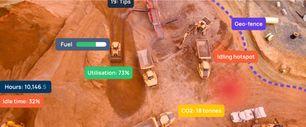
A subsidiary of Dutch energy company Royal Dutch Shell, MachineMax, produces equipment management platforms that connect to sensors positioned on various parts of off-road equipment to monitor its location, usage, and condition. “We connect all the heavy equipment assets that tend to be used in mining and construction to build complete remote visibility of what’s happening on-site through a single user interface,” explains Jennifer Thomson, Chief Growth Officer at MachineMax. “Operators can plug into the real-time data that we collect and use it in a smart way to understand what’s happening on-site and then take steps to improve the performance of their equipment and drive sustainability, efficiency, and profitability.”
Lina Alagrami
“We chose Google Cloud and Google Maps Platform because they can scale with us and cover the globe, and also because we knew what we wanted to build and the tools that we needed to do it and Google had them all, so we could use them from the start.”
Mapping out an integrated future
As geopositioning is such an integral part of MachineMax’s offering, it also needed to launch with a suite of tracking tools that would integrate with Google Cloud, and Google Maps Platform was the obvious choice.
“We chose Google Maps Platform because it made sense to work with another Google product, its functionality seemed to outperform its competitors, and from a usability perspective, people are familiar with its tooling, but most importantly it integrates with a large number of APIs for geometry, drawing, places, and visualization,” explains Riccardo Rizzo, Lead React and iOS Engineer at MachineMax.
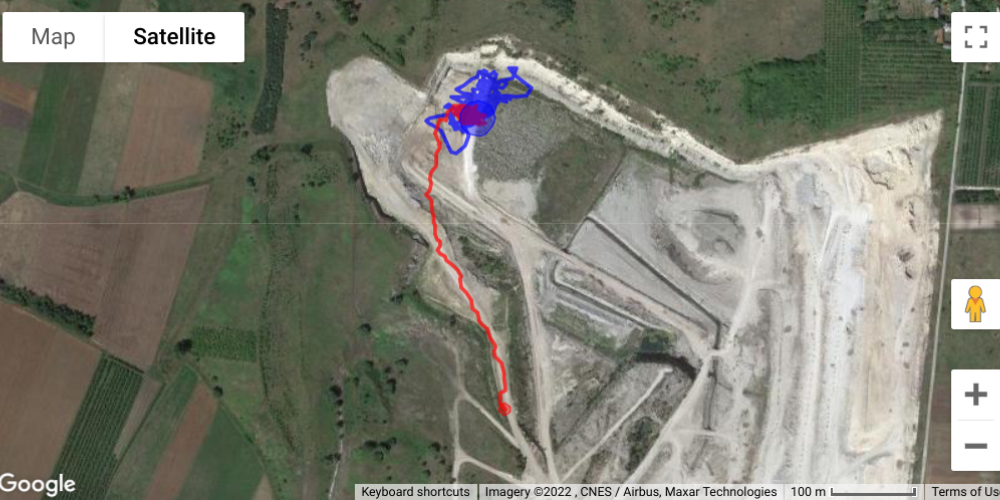
To provide a true representation of what is going on in a specific location, MachineMax uses a variety of APIs to show its customers the coordinates of where their off-road equipment is located, its condition, where it is in relation to other equipment in the field using geofences and to provide a visual picture with satellite imagery.
“With tools such as Heatmap Layer we can show, for example, excessive idling. This is where a vehicle or multiple vehicles are sitting with their engines on, burning fuel, emitting CO2, and being unproductive. And, we might even be able to show that this is happening because a load of dump trucks is backed up waiting to be loaded,” says Kate Stephen, Head of Product and Design at MachineMax.
Getting data from remote areas
Although MachineMax implemented its Google Cloud and Google Maps solutions in-house, it wanted to further improve the accuracy of its GPS. Google suggested it call on the support of Google Cloud Premier Partner, Localyse to help it with this specific issue.
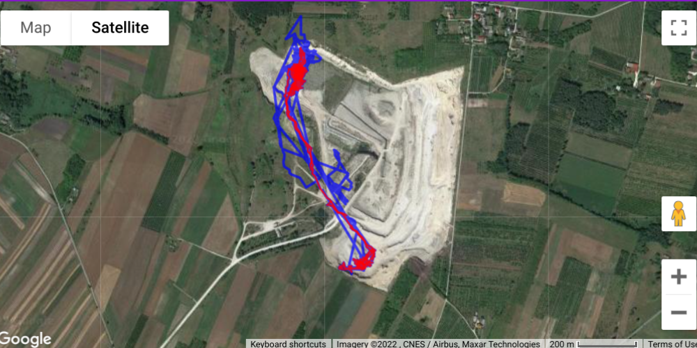
“We needed to try and increase the accuracy of our GPS, and there are several factors that can influence this, but the biggest factor is the number of satellites in view,” says Rizzo. “Localyse helped us to filter out all the GPS points that use a low number of satellites and also to use machine learning to reproduce a point from a previous point to help create a more accurate picture.”
Jennifer Thomson
“We know that with the support of Google Cloud and Google Maps, we can drill even deeper into the parameters of the data that we collect to help our customers become more profitable, more efficient, and more sustainable.”
Let's discuss your project
Looking for a way to make better decisions about your business’s location-based strategies? Look no further than Localyse!
Phone


