Optimised navigation in and around RCN’s international holiday parks
RCN is a company that manages holiday parks in the Netherlands, France, and Germany. While these parks were easily accessible through Google Maps, it was sometimes challenging to navigate to a specific holiday home or camping spot. This case study discusses four RCN parks where we made adjustments to improve navigation within and around the park.
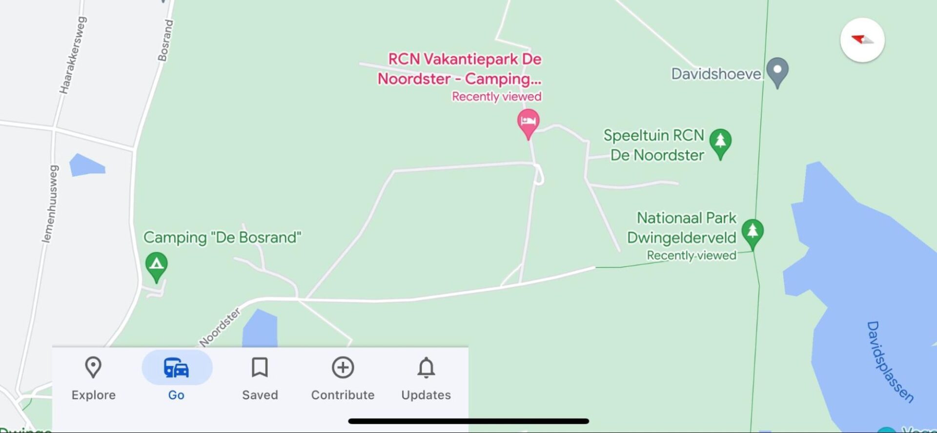
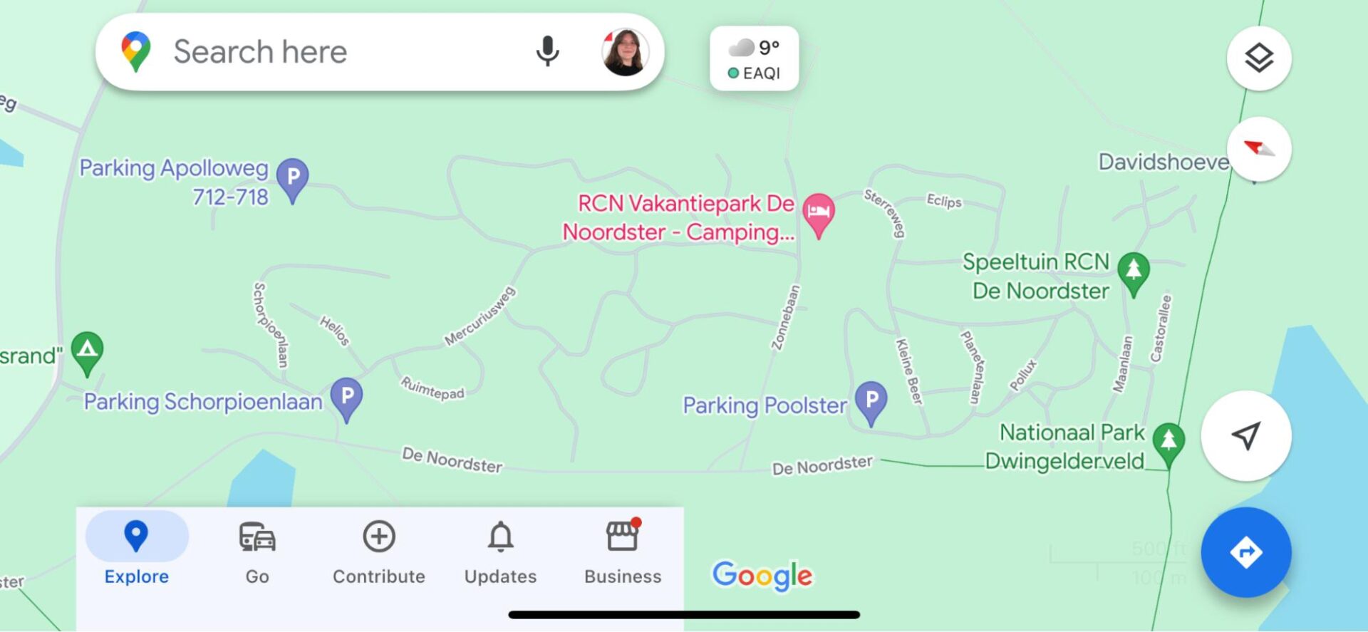
Holiday Park De Noordster was incompletely displayed on Google Maps, with only the route to the reception being correctly shown. To map the entire park, we relied on the map available on their website. Roads within the park were named, and parking spaces were added. This makes it easy to link Google Maps to the maps available at the reception. View the end result here.
Before:
After:
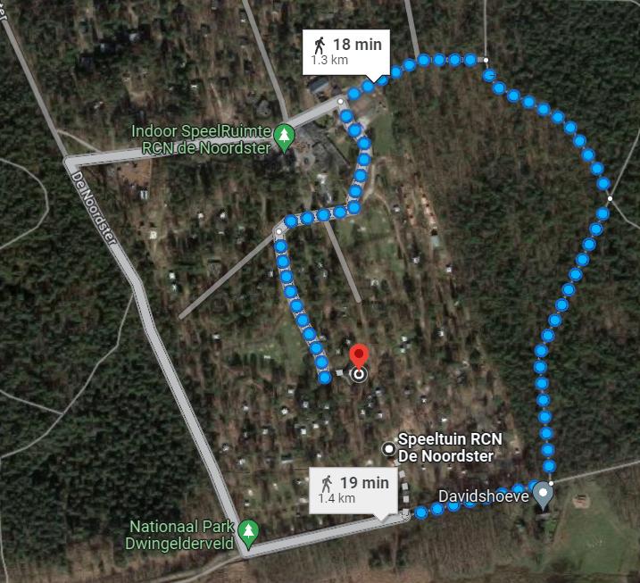
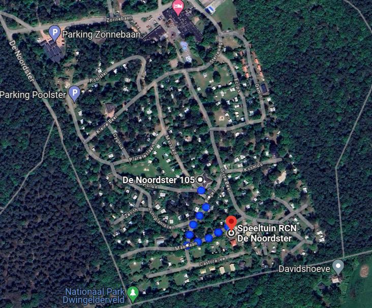
Example De Noordster
Previously, visitors were directed around the park to reach destinations such as the playground, reception, or a camping pitch. Now that the roads are included in Google Maps, routes within the park are accurately displayed.
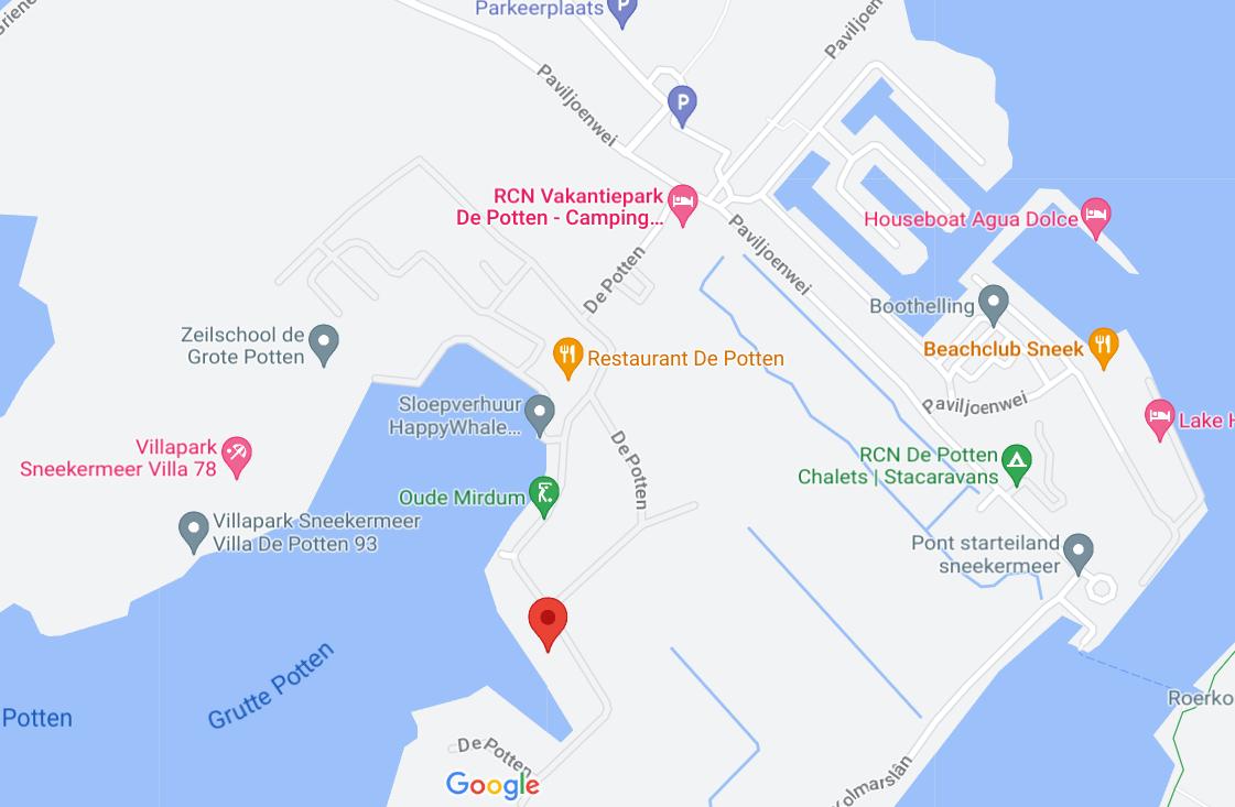
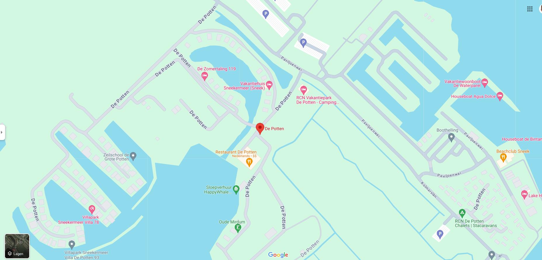
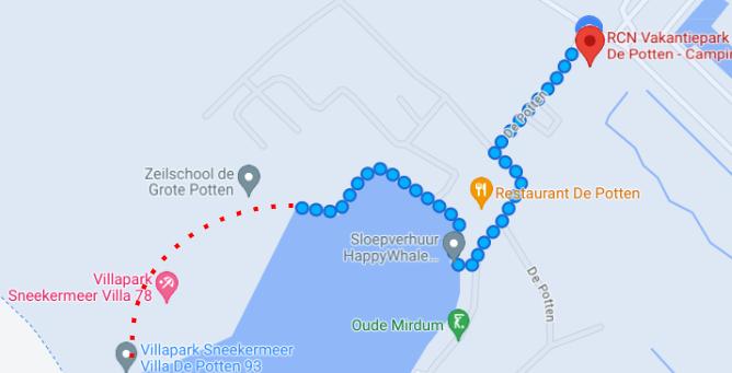
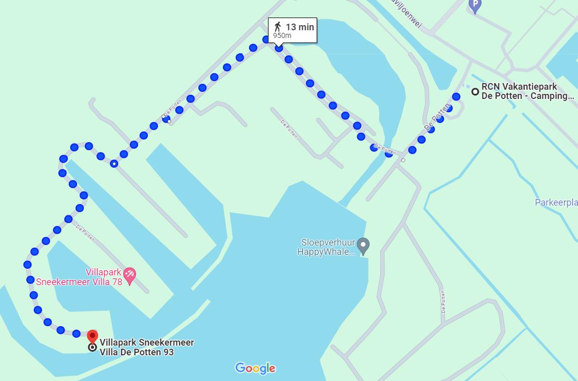
Holiday park De Potten was incompletely and inaccurately displayed, resulting in various navigation errors. Non-existent roads were shown, not all water features were visible, and parking spaces were missing. We corrected these errors and even added house numbers to the holiday homes, allowing visitors to navigate directly to their accommodation. Here you can see the updated version of the park.
Before:
After:
Example De Potten
Visitors to De Potten were not only directed along a non-existent road but also had to “jump” to reach the holiday home. After our adjustments, all locations within the park are accessible via existing roads.
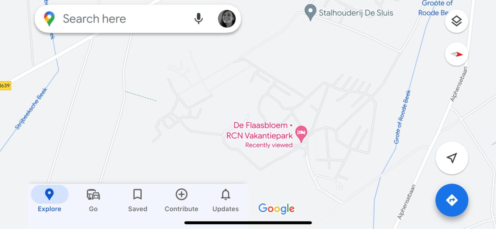
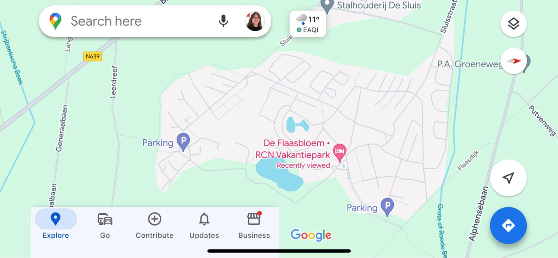
Since the roads within holiday park De Flaasbloem were mostly correctly displayed, fewer significant adjustments were needed. We corrected and added some roads, marked water features, and indicated parking spaces. This prevents visitors from being directed along incorrect or non-existent roads and allows multiple parts of the park to be visible on Google Maps thanks to the new roads. You can view the result here.
Before:
After:
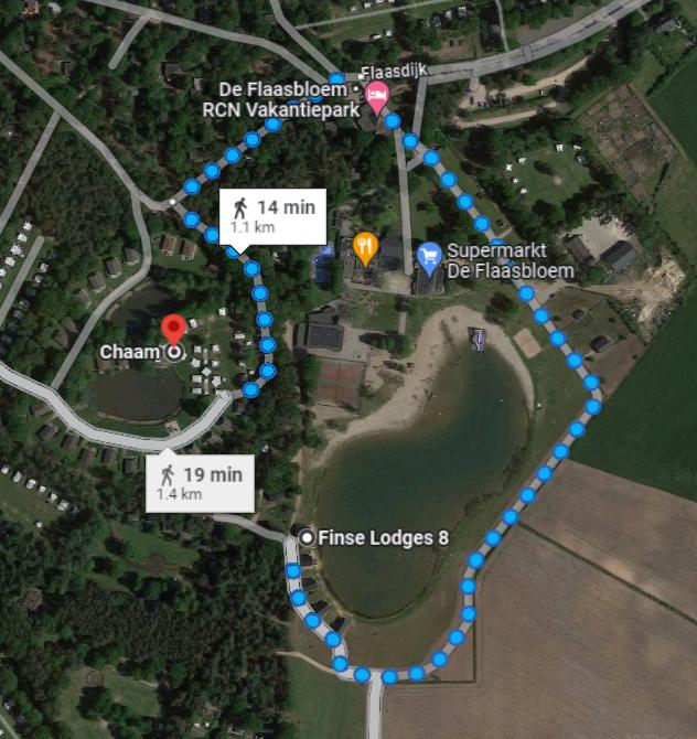
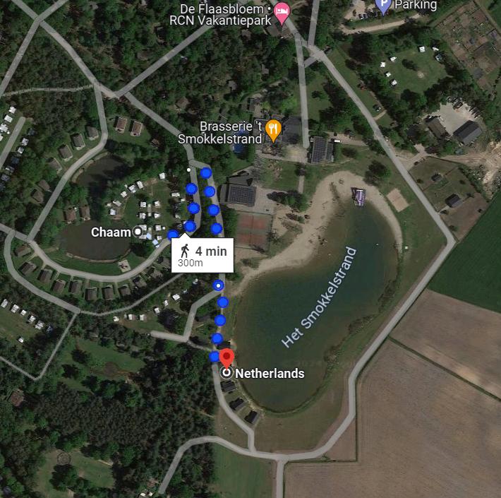
Example De Flaasbloem
Due to missing roads and footpaths, visitors were redirected 1 kilometer for a walk of only 300 meters. With the addition of footpaths, unnecessary detours will no longer be necessary.
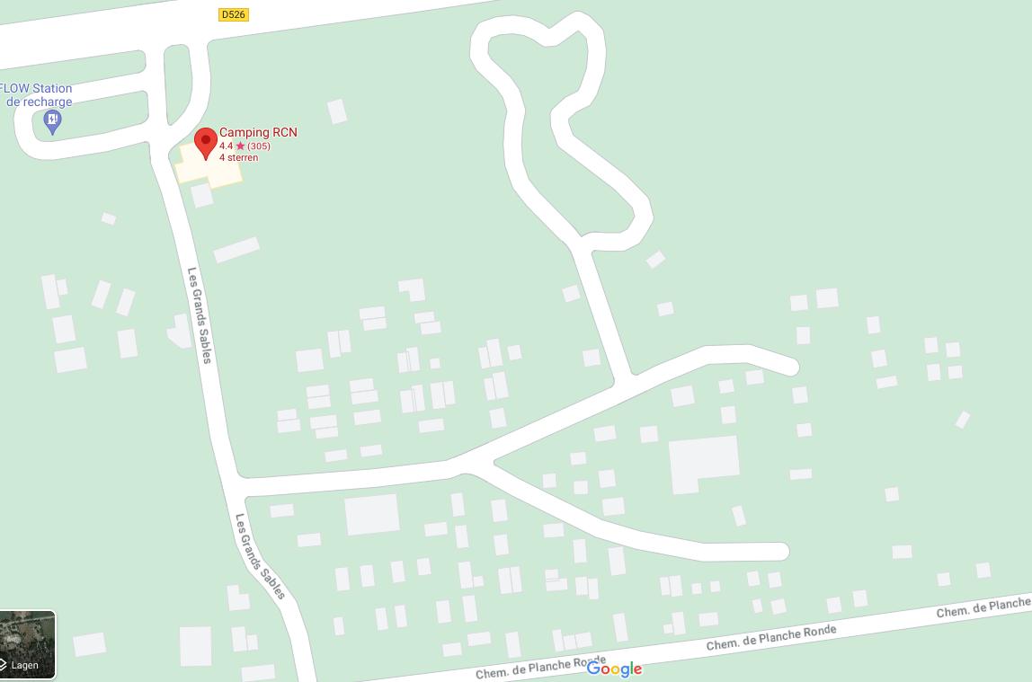
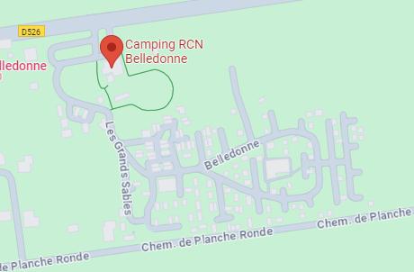
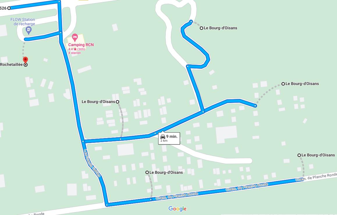
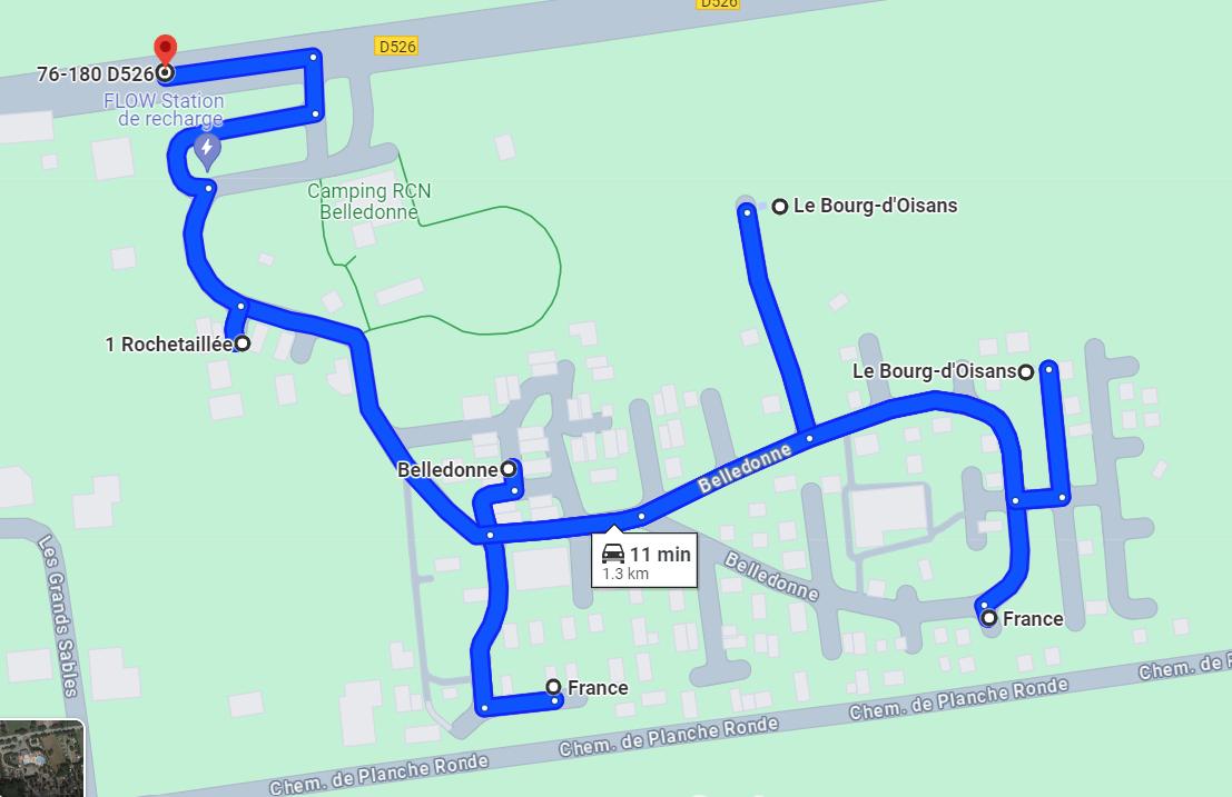
Like De Flaasbloem, Belledonne was also incompletely displayed. Additionally, there was a mistaken connection between the road and the park, leading visitors to a non-existent entrance. We corrected this error and added the remaining roads. The result can be seen here.
Before:
After:
Example Belledonne
Belledonne had a road incorrectly connected to Chemise de Planche Ronde, resulting in inaccurate navigation within and outside the park. By removing this incorrect connection and fully mapping the park, we prevent erroneous navigation.
Before:
After:
Let's discuss your project
Would you like to be sure that your location is easy to find and access? Feel free to contact us via the contact form below. We are happy to think along with you and provide insight into potential improvements to your visibility and accessibility.
We and our partners use information collected through cookies and similar technologies to improve your experience on our site, analyse how you use it and for marketing purposes. You can find out more in our privacy policy.
Your privacy settings
We and our partners use information collected through cookies and similar technologies to improve your experience on our site, analyse how you use it and for marketing purposes. Because we respect your right to privacy, you can choose not to allow some types of cookies. However, blocking some types of cookies may impact your experience of the site and the services we are able to offer. In some cases, data obtained from cookies is shared with third parties for analytics or marketing reasons. You can exercise your right to opt-out of that sharing at any time by disabling cookies.
Privacy policy
These cookies and scripts are necessary for the website to function and cannot be switched off. They are usually only set in response to actions made by you which amount to a request for services, suchas setting your privacy preferences, logging in or filling in forms. You can set your browser to block oralert you about these cookies, but some parts of the site will not then work. These cookies do notstore any personally identifiable information.
Analytics
These cookies and scripts allow us to count visits and traffic sources, so we can measure and improve the performance of our site. They help us know which pages are the most and least popular and see how visitors move around the site. All information these cookies collect is aggregated and therefore anonymous. If you do not allow these cookies and scripts, we will not know when you have visited our site.
Embedded Videos
These cookies and scripts may be set through our site by external video hosting services likeYouTube or Vimeo. They may be used to deliver video content on our website. It’s possible for the video provider to build a profile of your interests and show you relevant adverts on this or other websites. They do not store directly personal information, but are based on uniquely identifying your browser and internet device. If you do not allow these cookies or scripts it is possible that embedded video will not function as expected.
Marketing
These cookies and scripts may be set through our site by our advertising partners. They may be used by those companies to build a profile of your interests and show you relevant adverts on other sites. They do not store directly personal information, but are based on uniquely identifying your browser and internet device. If you do not allow these cookies and scripts, you will experience less targeted advertising.
Facebook Advanced Matching
Facebook Advanced Matching can improve ads attribution and conversion tracking. It can help us reach better-targeted custom audiences through our ads. When possible, we will share with Facebook hashed information like your name, phone, email, or address.
Facebook CAPI
Facebook Conversion API Events (CAPI) help us better understand how you interact with our websites. They allow us to measure the impact of our ads on the website's conversions and they improve ads targeting through custom audiences. When possible, we might share with Facebook information like name, email, phone, address.