Google Premier Partner specialized in Location-Based Services.

PAXX pushes boundaries with complex route planning

Scale-up PAXX has developed a technically advanced solution based on Anymap and Google Cloud Platform to perform target group transportation more efficiently and reliably. Every year there are about 60 million cab rides in Dutch target group transportation. The planning of these no longer needs to be done by people, and this results in the highest possible efficiency and improvement of service quality.

Target group transport is the largest share of the cab market in the Netherlands: it includes passengers who qualify for substitute public transport, pupils in special education or pupils who cannot attend regular education in the immediate vicinity and seated patient transport.

In order to keep the costs of the target group transport under control, passengers are transported in combination. Moreover, combining is more sustainable; it ensures that fewer miles are driven, which leads to less energy consumption.
logo

Humans and a smart algorithm

For a carrier, working more efficiently is necessary. “But scheduling these kinds of trips is a complex puzzle,” Quintin van Gemert explains. He is CEO of PAXX. His scale-up was founded in 2020 to develop various innovative solutions for target group transportation. “We see that people benefit from smart algorithms.” Right now, companies always create basic schedules a day in advance. But every day is different, so those schedules are theoretical and far from what would be the best choice in practice.

PAXX’s platform pairs drivers and cab vehicles with people with specific requirements. This allows vehicles to be used in the best possible way and suggested the best routes. The system was named MerQurius. Van Gemert: “MerQurius has to process a lot of complex data combinations and continuously calculate the best routes using the current traffic situation.”
eenvoudig reserveren edited 640x400 1

Geographic challenge

Creating the solution was technically a huge challenge, Van Gemert explains. Rory Baart, CTO at PAXX, designed MerQurius’ algorithm. “The first challenge we had was geographical. We wanted to be able to calculate how to efficiently schedule as many bookings as possible into routes. The fewer drivers you schedule, the more remain available for trips that are going to be booked later.”

To do that, the system needs to know where everyone is, both drivers and travelers who have checked in. “With real-time data of the traffic situation, MerQurius can calculate the duration of all possible routes very accurately. This makes any planning more reliable. It can then dynamically decide that it is better for one driver to detour a stretch for an additional traveler, so that another driver can get his travelers to their destination on time.”

image1

Mathematical challenge

The second step was a mathematical challenge. Baart: “We wanted an algorithm that could generate lots of route options and make the optimal selection from them.” This is different from what people do when planning: people work intuitively and plan routes one at a time and far ahead. For example, planners reserve extra time for traffic jams they expect. But that time is almost always too tight or too generous, Baart explains. “Only by generating new route options live all the time can we calculate and adjust optimal routes.”

The system must also take business rules into account. For example, one rule is that if a traveler needs to be picked up from his/her room (special requirement), the car must be locked. The car must then also be empty. Such frameworks are crucial when planning and combining trips in this industry.

tracking e1699952382773 640x400 1

The challenge of balancing

PAXX also wanted the algorithm to be able to make choices based on the characteristics of the travelers themselves. Baart: “Traffic can be adverse and then this situation can occur: picking up one traveler much too late or picking up two people a little too late. We can give a weight to each requirement in MerQurius, so it can make choices in that as well. Someone on a birthday might be able to be picked up later. But someone with a hospital appointment might not be able to wait.”

It managed to put many different trade-offs into MerQurius. Van Gemert: “We built an algorithm that is extremely flexible: it takes into account all the characteristics of the drivers, vehicles and the travelers who need to get from A to B. It calculates the optimal routes continuously. It continuously calculates the optimal routes for all bookings. The drivers only have to follow the routes that the navigation gives them. Planners of the past are now working on special cases. They keep an eye on whether the system is making the right decisions in exceptional situations and intervene when necessary.”

image

High intensity of data requests

“MerQurius could only get there with help from Localyse,” says Van Gemert. “Customization was needed to optimize routes in real-time with many variables. The Google Cloud Platform is the only platform that can handle so many data requests from the system.” The intensity is high because of the hundreds of trips that sometimes need to be booked and monitored at the same time; requests are sent all the time to get another up-to-date picture of the situation. Google Cloud Platform can handle that large amount of data processing through Kubernetes.

MerQurius further primarily uses Anymap. “There are many locations that we use to do new calculations with the current traffic situation,” he said. For hundreds, thousands of positions, the system is going to keep calculating possible routes. Since Anymap also runs in the Google Cloud Platform and uses Kubernetes, the system never fails.

drive 863123 1280

Boundaries shifted

The result is impressive. With their system MerQurius, PAXX offers a fully automated specialized trip planner that runs on their self-developed algorithms. Van Gemert: “This smart automation was not possible until recently. We have pushed boundaries, overcome the challenge and are ready to scale up.”

The technical part of PAXX’s challenge is over: the algorithm works, and with it, the special transportation cab industry has been optimized. PAXX has been working on a technical solution that allows scaling up so that more transport companies can be added to the network. “We can have dozens of organizations running on our platform at the same time,” he said.

image2

Also for other types of carriers

PAXX also wants to be able to add other types of carriers to their platform. After target group transportation, they want to expand their product to group transportation of children: student transportation.

Van Gemert: “The biggest challenge ahead is to teach users to trust the system.” Drivers, operators and other employees have to get used to trusting the computer’s planning. Except in special cases, when they do have to intervene. “And human mistakes, like missing a turn, continue to happen. MerQurius adapts quickly to their impact. That’s the beauty of it.”
ratings edited 1024x1024 1 640x400 1

Let's discuss your project

Looking for a way to make better decisions about your business’s location-based strategies? Look no further than Localyse!

Email

Phone

🇳🇱 +31 (0)172 25 55 00 

Optimised navigation in and around RCN’s international holiday parks

RCN is a company that manages holiday parks in the Netherlands, France, and Germany. While these parks were easily accessible through Google Maps, it was sometimes challenging to navigate to a specific holiday home or camping spot. This case study discusses four RCN parks where we made adjustments to improve navigation within and around the park.

logoRCN v2

1. De Noordster

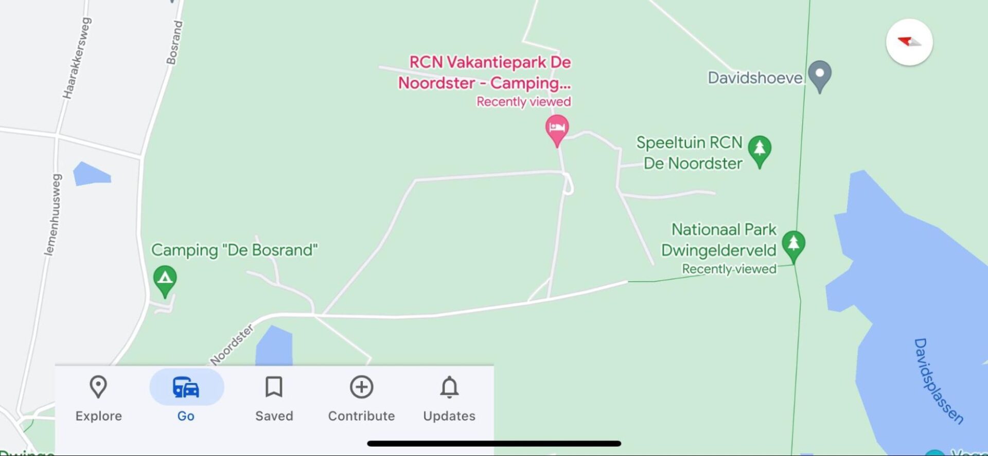
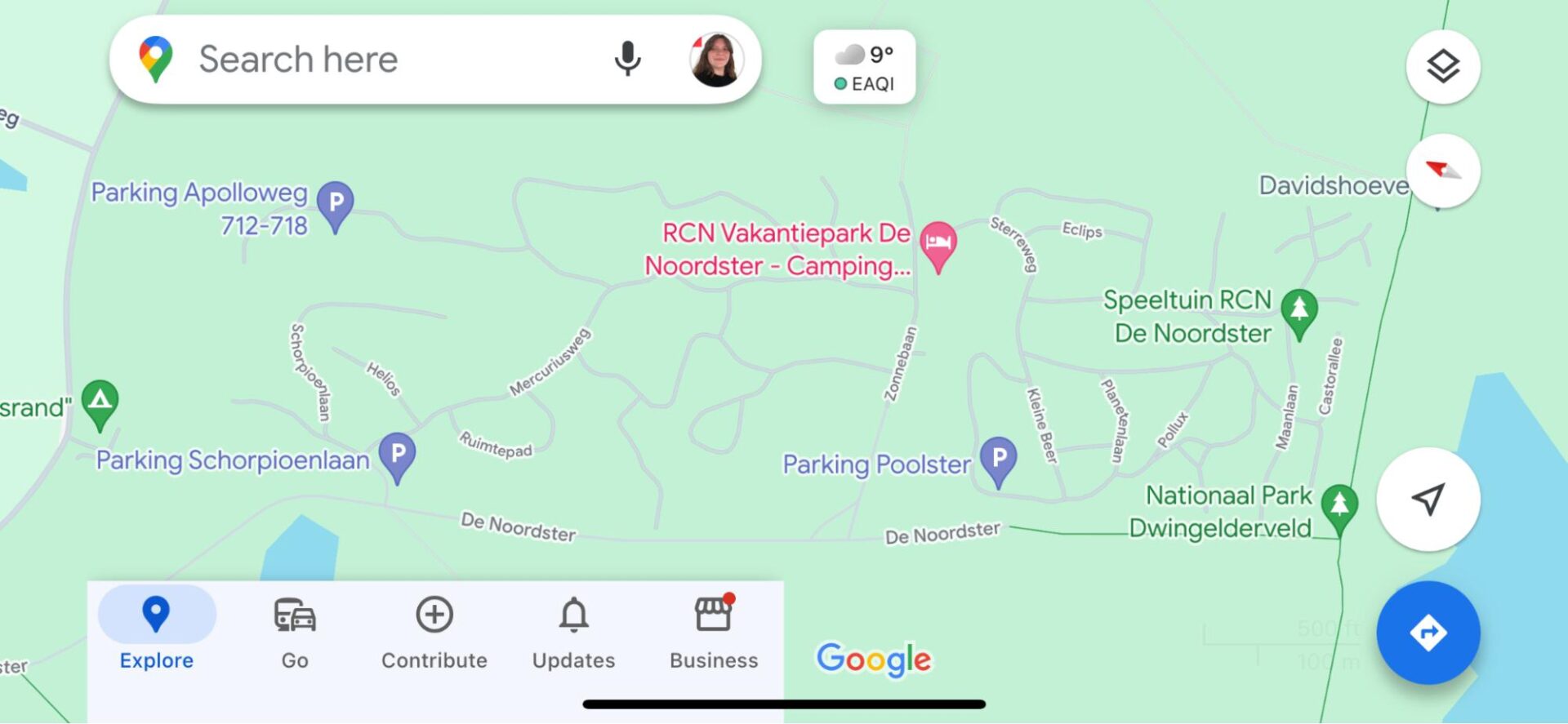
Holiday Park De Noordster was incompletely displayed on Google Maps, with only the route to the reception being correctly shown. To map the entire park, we relied on the map available on their website. Roads within the park were named, and parking spaces were added. This makes it easy to link Google Maps to the maps available at the reception. View the end result here.

Before:

image11 scaled

After:

image7 scaled

Example De Noordster

Previously, visitors were directed around the park to reach destinations such as the playground, reception, or a camping pitch. Now that the roads are included in Google Maps, routes within the park are accurately displayed.

Before:

image13

After:

image12

2. De Potten

Holiday park De Potten was incompletely and inaccurately displayed, resulting in various navigation errors. Non-existent roads were shown, not all water features were visible, and parking spaces were missing. We corrected these errors and even added house numbers to the holiday homes, allowing visitors to navigate directly to their accommodation. Here you can see the updated version of the park.

Before:

image9

After:

image14

Example De Potten

Visitors to De Potten were not only directed along a non-existent road but also had to “jump” to reach the holiday home. After our adjustments, all locations within the park are accessible via existing roads.

Before:

image1

After:

image10

3. De Flaasbloem

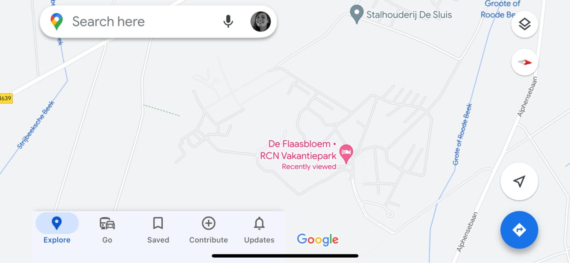
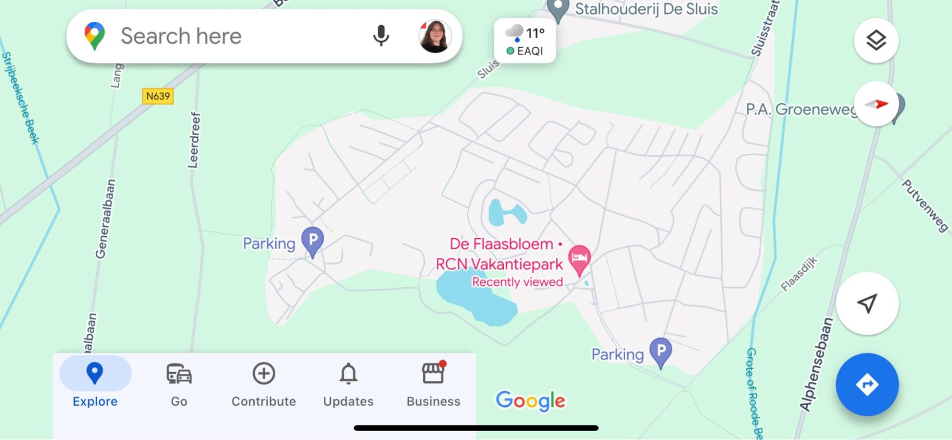
Since the roads within holiday park De Flaasbloem were mostly correctly displayed, fewer significant adjustments were needed. We corrected and added some roads, marked water features, and indicated parking spaces. This prevents visitors from being directed along incorrect or non-existent roads and allows multiple parts of the park to be visible on Google Maps thanks to the new roads. You can view the result here.

Before:

image8 scaled

After:

image2 scaled

Example De Flaasbloem

Due to missing roads and footpaths, visitors were redirected 1 kilometer for a walk of only 300 meters. With the addition of footpaths, unnecessary detours will no longer be necessary.

Before:

image15

After:

image4

4. Belledonne Frankrijk

Like De Flaasbloem, Belledonne was also incompletely displayed. Additionally, there was a mistaken connection between the road and the park, leading visitors to a non-existent entrance. We corrected this error and added the remaining roads. The result can be seen here.

Before:

image5

After:

image3

Example Belledonne

Belledonne had a road incorrectly connected to Chemise de Planche Ronde, resulting in inaccurate navigation within and outside the park. By removing this incorrect connection and fully mapping the park, we prevent erroneous navigation.

Before:

image6

After:

image16

Let's discuss your project

Looking for a way to make better decisions about your business’s location-based strategies? Look no further than Localyse!

Email

Phone

🇳🇱 +31 (0)172 25 55 00 

More accurate navigation to and within Kleefse Waard on Google Maps

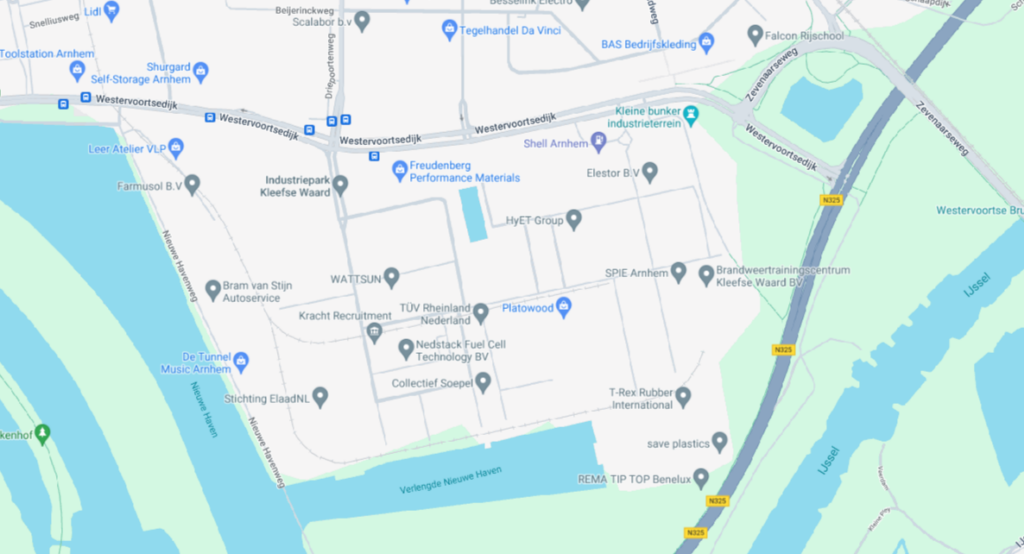
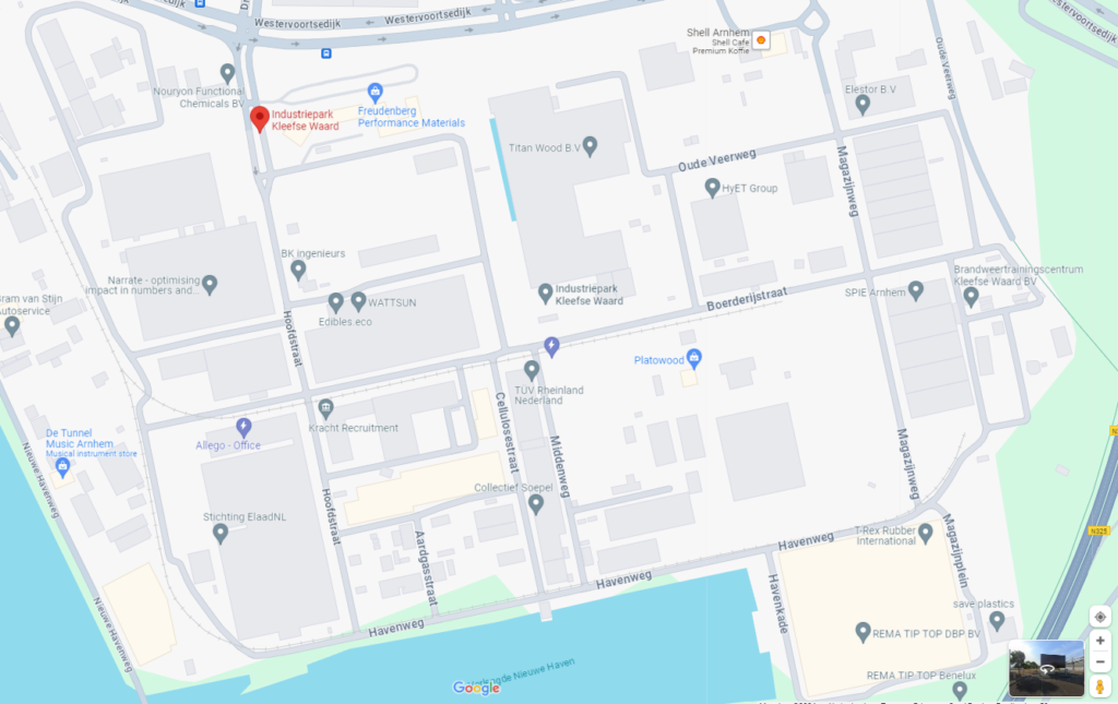
Kleefse Waard Industrial Park, located in Arnhem, is home to numerous energy-related businesses. However, despite its significance, the industrial park faced challenges in terms of accurate navigation in Google Maps. This case study elucidates the issues encountered and the solutions implemented to enhance navigation accuracy to- and within the industrial park.

Logo IPKW

1. Inaccurate route guidance

Problem

Google Maps frequently supplied incorrect information when guiding users from locations outside the park to a business situated within its boundaries. 

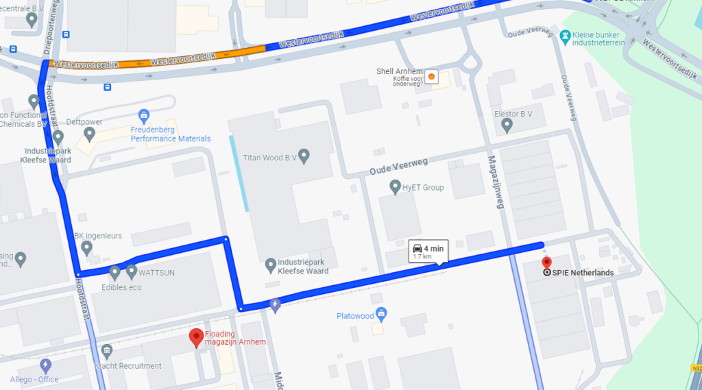
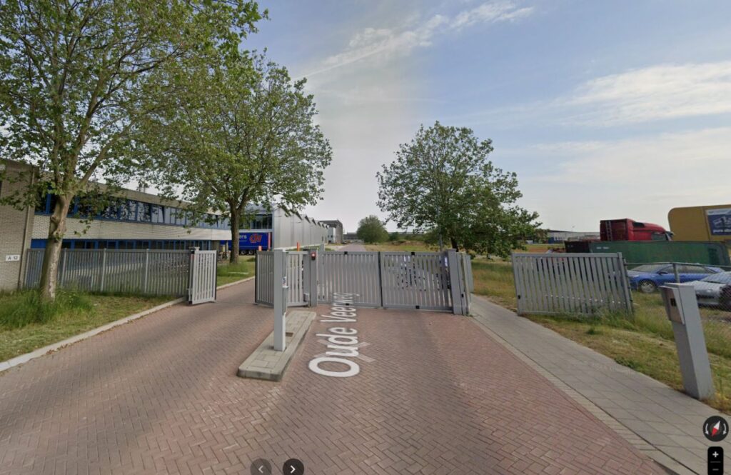
Google Maps users were directed beyond a gas station to a gate inaccessible to the public, resulting in significant issues, particularly for trucks. They were forced to reverse and maneuver at the gas station exit, leading to road damage and hazardous traffic conditions.

Result

We modified the map to prevent any navigation through the gate. As a result, users are now directed through the front entrance, eliminating the need for unnecessary turns near the gas station. Additionally, this adjustment saves fuel and prevents further damage to the road.

Before:

image5

After:

image3

Entrance before:

Scherm afbeelding 2024 04 29 om 13.31.07

Entrance after:

Scherm­afbeelding 2024 04 29 om 13.31.07

2. Incomplete mapping data

Problem

Certain areas within the industrial park were not accurately represented on Google Maps, leading to difficulties in locating specific businesses or facilities.

Result

Users can easily navigate to any location within Kleefse Waard without encountering any issues.

Before:

image2

After:

image4

Results

Established companies are more motivated to update their own company profiles.

  • “With an appointment confirmation on the domain, we send along a QR code to open the gate. With that, we now also send Google route advice along with it.”
  • “We have avoided problems during our events that attract an average of 450 visitors. These visitors now have a much better customer journey.”
  • “We have far fewer questions about finding the destination. There are also fewer trucks getting stuck. To be completely sure of optimal traffic flow, we awarded Localyse the 2nd contract to also update Tomtom, OSM and HERE. This is mostly what trucks use.”
Maurice den Biesen

Maurice den Biesen

Business developer/Project manager

“Google sent our visitors to a wrong entrance. I asked Localyse to correct Google Maps so that everyone would enter our business park through the main entrance. When I returned from my holiday, Localyse had already set everything right. We didn’t expect it that quickly. Now that everything is right, the established companies are motivated to update their own POIs as well.”

Let's discuss your project

Looking for a way to make better decisions about your business’s location-based strategies? Look no further than Localyse!

Email

Phone

🇳🇱 +31 (0)172 25 55 00 

Transferz – Firm cost savings with Google Maps API

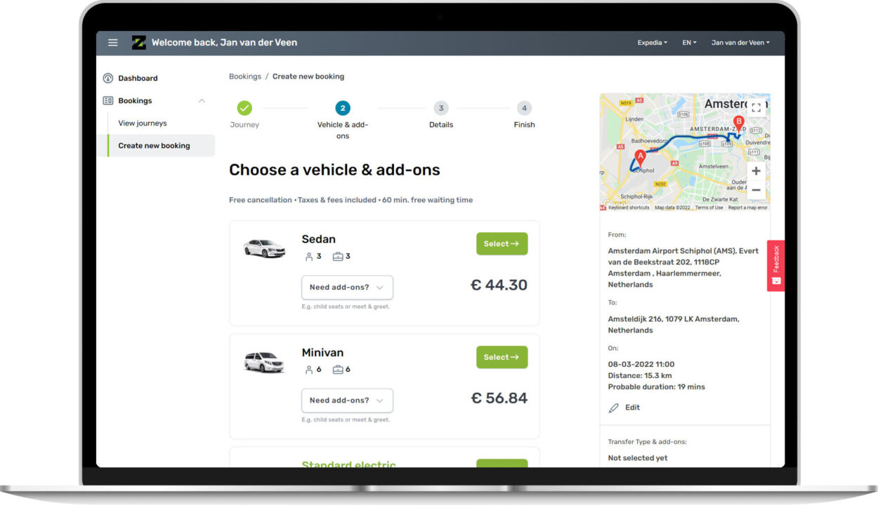
Transferz is a Dutch technology company that has developed a ground transportation API and offers it to their clients to integrate into websites such as Booking.com. They allow major players in the tourism- and holiday-sector, such as vacation websites, airlines, hotel chains, etc., to easily offer various transportation services to their customers, via their website. 

TransferZ logo black 1

Challenge

In view of the growth trajectory that Transferz wants to go through in the coming years, it was necessary to improve the integration of location services within their product. They also needed to look at a way to get a better handle on technology costs within the company. Transferz first tried to address these issues internally, but it soon became clear that this was not the right way. They needed more specific specialism and know-how.

Transferz was therefore mainly looking for a partner who could support them in this process, both in terms of technical optimization and costing. In addition, it was extremely important that such a partner be a valuable discussion partner who understood their business.

Jan van der Veen

Jan van der Veen

Chief Technology Officer

“Google Maps is a vital part of our innovative ground transportation platform. Localyse ensures we’re up-to-date with the latest developments and helps us keep our Google Maps costs in check.”

What did Localyse do?

One of the issues Localyse immediately addressed, was the Google Cloud backup routine that Transferz used on a daily basis. By optimizing this, Localyse ensured that the company will save nearly 68% annually

In addition, Localyse provided a solid review and optimization of Google Maps usage and associated costs, and Localyse helped them submit a Google Refund Request. As a result, Transferz recovered 22% of their monthly fees. These costs were previously much higher, due to incorrect API usage that was discovered and rectified by Localyse

Localyse also manages Transferz’s Google Cloud infrastructure to ensure a streamlined and efficient operation. Localyse also maintains an improved management environment, security and limit settings, so that the CTO of Transferz will no longer get any unpleasant surprises.

Partner Portal 1250x720 1

Results

Localyse, through their Customer Success Program, ensures that Transferz now consistently get all the support they need. Service agreements have been made so that Localyse continues to maintain a proactive role for all kinds of issues. Exactly what Transferz expects from a Premium partner with ‘Location based specialization’! 

Thanks to Localyse’s intervention, many processes, including Google Maps and API integration, internal cost structures and the use of Google Cloud, were visibly optimized.

Even today, Localyse will continue to assist Transferz where necessary. Localyse keeps a close eye thanks to quarterly meetings with Transferz, during which Transferz receives advice and assistance, and Localyse can always intervene and support if necessary!

Let's discuss your project

Looking for a way to make better decisions about your business’s location-based strategies? Look no further than Localyse!

Email

Phone
🇳🇱 +31 (0)172 25 55 00 

Monizze – Intuitive Google Maps map with clustering

Monizze, a Belgian SME initiative, is a 100% digital Fintech company. Monizze connects individuals and companies by developing management and transaction platforms that contribute to their well-being and efficiency. Monizze develops integrated solutions that perfectly meet the needs of our various target groups: meal, eco and gift vouchers. In 2015, Monizze joined Up Group, n°3 worldwide, in the special payment voucher market. Monizze has since exceeded the counter of 50,000 customers, ranging from large companies such as KBC, Colruyt, Alken Maes and Comeos to SMEs and the self-employed. We are happy to let Monizze talk about our collaboration here.

monizze logo

The necessary expertise for a dynamic map solution

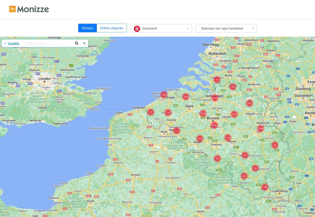
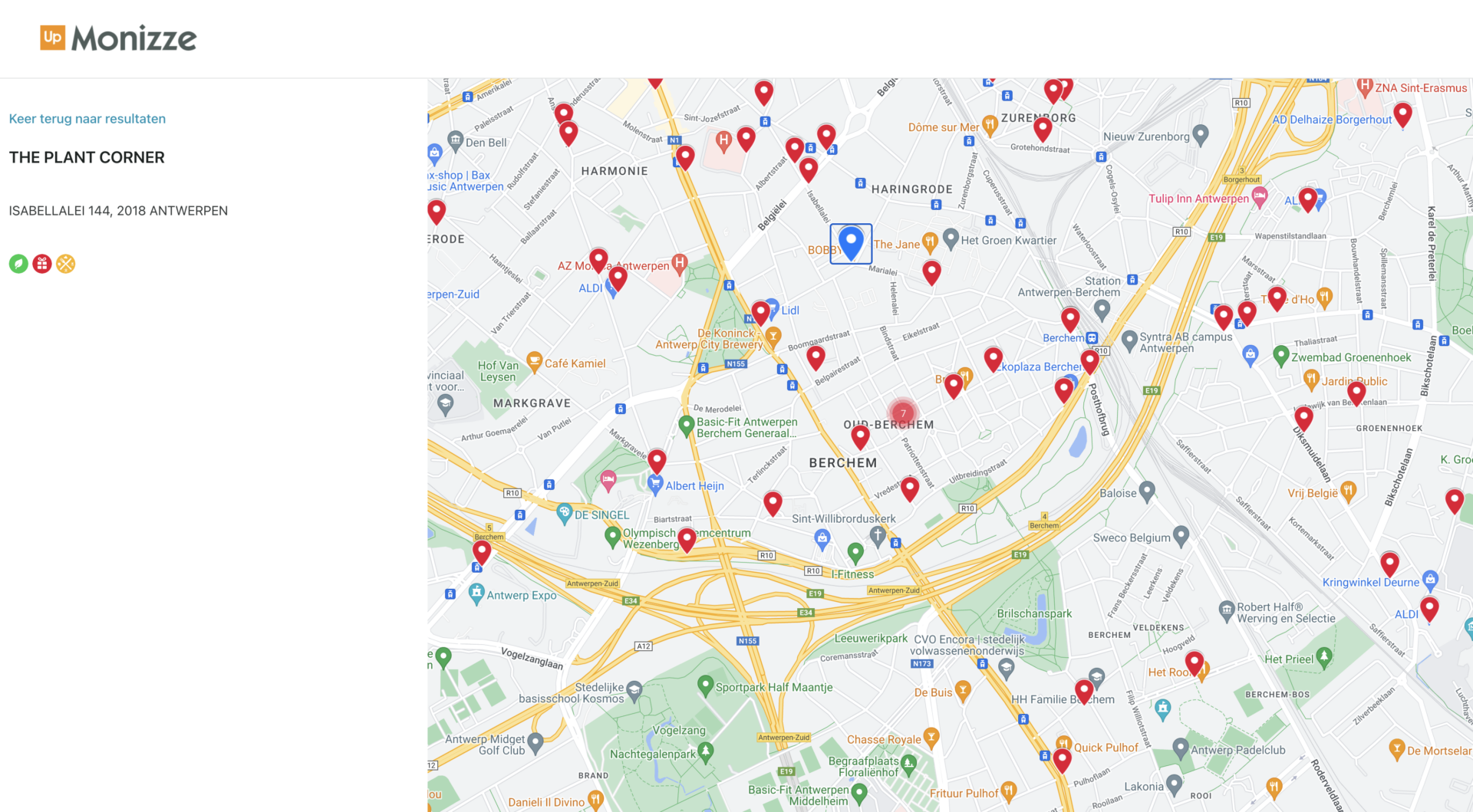
Google Maps has been around for 5 years; we used this to show where Monizze vouchers can be used by means of a digital map. Customers usually look at the map each time vouchers are issued to see where they can consume them. The card solution was in need of replacement. At first, Monizze turned to another party, but it soon found that there was insufficient knowledge and expertise. So Monizze found Localyse, and they first conducted an audit of the Google Maps APIs implementation. This quickly showed that many improvements could be made. From there, Localyse made the necessary optimisations in a short time—the result was a user-friendly and intuitive Google Maps map with clustering.

CleanShot 2023 05 25 at 10.58.15@2x
Jean- Louis Van Houwe

Jean- Louis Van Houwe

CEO of Monizze

“Thanks to our partnership with Localyse, Monizze can offer its more than 800,000 employees, who receive social benefits from their employers, a new and user-friendly portal to find the best shop to spend their Monizze vouchers in our extensive network of more than 55,000 merchants”

From a static to an interactive map

Challenge

We received many comments at the time of the ‘old’ map, which ran on a WordPress website. Users commented that it was not user-friendly. Moreover, the map was not aligned with our goal: to be a digital scale-up. So that includes a modern, well-functioning Google Maps integration. Besides consumers, our own salespeople also use this application regularly. During sales meetings with potential customers, they show where the employees of the prospect can use their Monizze vouchers. So it was not only crucial for consumers to change but internally for our sales team as well.

Solution

On top of that, little interaction was possible with the old map. Now there is a nice dynamic map where you can apply filters. It works very dynamically and quickly. Moreover, the clustering of markers also gives an overview of the providers in the region. Indeed, if we were to show them all via a pin on the map, the map would disappear completely. Finally, Localyse still offers us advice in further modernising and fine-tuning our Google Maps integration.

CleanShot 2023 05 25 at

Results

Because the old map didn’t work properly, we used to get a lot of negative calls from our customers. Thanks to the Google Maps Platform, we received 200% fewer calls to our customer service department about the acceptance network map. Since the implementation, Monizze is achieving higher satisfaction scores from both the sales team and consumers. We also see a much more stable environment with no crashes, outages or loading issues. We are even looking at how to expand current services on the map.

Let's discuss your project

Looking for a way to make better decisions about your business’s location-based strategies? Look no further than Localyse!

Email

Phone
🇳🇱 +31 (0)172 25 55 00 

Social Deal – Attract more local customers with Google Maps

Social Deal is a Dutch success where consumers can buy local experience and market leader in the BeNeLux with a 50 million turnover yearly and looking for European growth. Google Maps technology supports us to easily expand without the need of changing the map technology. Joining the platform, partners see a growth revenue, optimise the occupancy rate and attract more new local customers.

logo social deal

The Challenge

Social Deal is a platform on which the most interesting deals in the region are available. To display these deals, we needed a user-friendly environment. It’s key that the ordering process goes very smoothly and only takes a few clicks. Monthly over 1 million experiences are sold. A map to visualise the deals was preferred, a list view would be too cluttered.

The Solution

Google Maps proved to be a great success! We were directly capable to visualise all of our deals in an organised way without sacrificing user friendliness. In fact, Google Maps was our only option because consumers already know this map. Now we visualise all of our deals on the map and the user knows directly where they are. Another big advantage is that we are able to expand in the EU easily.

Scherm­afbeelding 2023 05 25 om 11.33.35
Rens van den Berg

Rens van den Berg

CEO Social Deal

“Localyse helped us by providing volume discounts and with valuable advice about the APIs. They keep us posted on the newest developments of Google Maps Platform. As they are a local partner it’s convenient that we can conversate in our own language.”

The Results

Social Deal is growing enormously, every two years we double our customer base and offerings. The integration with Google Maps Platform supports this growth strategy. By adding the “nearby” functionality customer satisfaction has grown 10% and bounce ratio has dropped 20%. Using another mapprovider wasn’t an option since it would detract from our website.

Let's discuss your project

Looking for a way to make better decisions about your business’s location-based strategies? Look no further than Localyse!

Email

Phone

🇳🇱 +31 (0)172 25 55 00 

Prato – Ideal job dispatching based on travel time & distance

Prato is a Belgian company that offers innovative HR software and services. Clients include interim agencies, service cheque companies and enterprises. Prato helps with automation of payroll and personnel administration as well as well-founded social-legal advice. The company is part of geneHRations, a network of HR-tech entrepreneurs that implement innovative solutions and turn them into profitable business.

Prato19 RGB LOGO

Some background

Among other HR tech solutions, Prato offers software for service voucher companies to automate the assignment of cleaning staff to households.

Service voucher companies employ cleaners and generate revenue via a voucher system set up by the Belgian government: They can redeem one voucher for each cleaning hour, regardless of the circumstances. In order to make a profit, these companies need to optimize the working hours of their employees for cleaning time to avoid long commutes and planning efforts.

To help these companies with their scheduling, Prato’s software calculated travel times and distances for all employees. However, when their previous API provider’s prices suddenly increased significantly, their entire product was at stake. For this reason, Prato’s Technology Lead Tim Pijpops and Product Owner Daan Gielen asked Localyse for a new solution: Targomo came into play.

Sustaining a profitable product

Challenge: Sustaining a profitable product

Prato’s solution for service voucher companies has been on the market for years, but it unexpectedly came into jeopardy: “The cost of our previous API provider suddenly skyrocketed, making our product virtually unsellable,” Tim Pijpops explains. He turned to Localyse, which had previously supported his API implementation, in search of an alternative.

Solution: Quick & smooth transition to Targomo’s API

Localyse proposed Targomo’s Travel Time and Routing APIs as a cost-effective and powerful alternative. “Localyse’s engineers came to our office and provided hands-on support in implementing the new technology, so Prato could continue to offer its product for a reasonable cost increase” says Daan Gielen. Travel time calculation is at the heart of Prato’s product, as it is central to optimizing employee commute times. After extensive testing of the previous and new calculations, all of Prato’s customers smoothly migrated to Targomo’s API within a few months.

Ontwerp zonder titel 12

Employees use different modes of transport

Challenge: Employees use different modes of transport

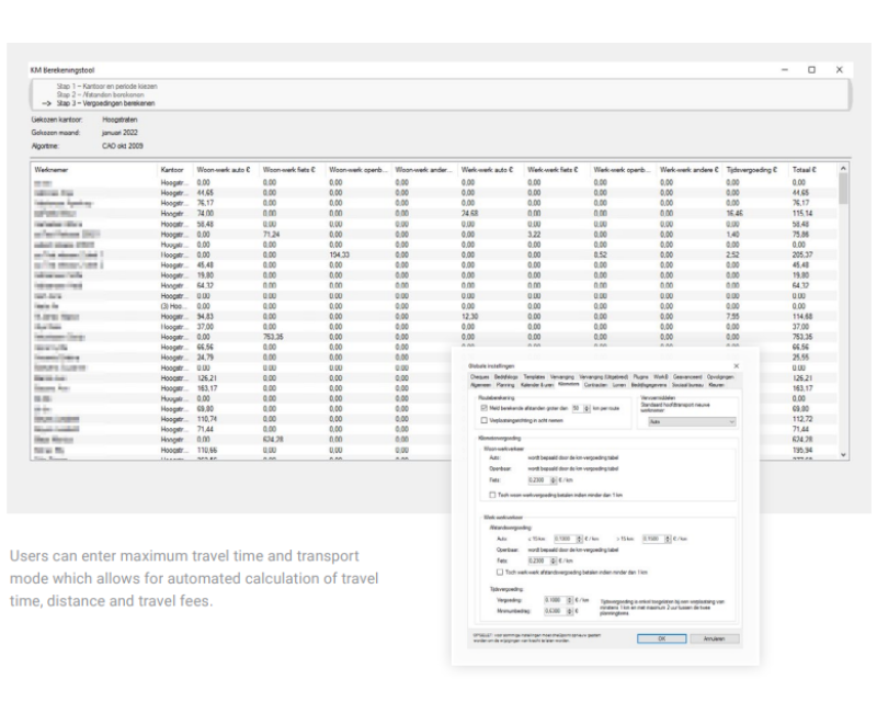
Service voucher companies have to take into account that their employees in general prefer different modes of transportation to reach the households. They also have to be able to consider daydependent variations in the means of transport to still calculate correct data for the billing process.

An employee travelling by public transit will necessarily lead to other travel time calculations than the same employee travelling by car, and travelling by car during rush hour will take longer than outside.

Solution: Travel times and distances are based on means of transportation

Once the relevant transport modes were defined, Localyse implemented Targomo’s Travel Time API in a way that allows Prato’s software users to customize their calculations: Per employee, they can set a standard mode of transportation (i.e. “car”, “bike”, “e-bike”, “transit”) and adjust it for specific days.

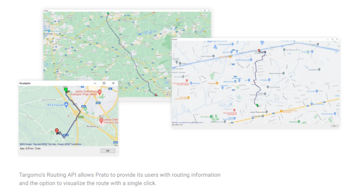
Targomo’s API then automatically takes into account travel speed, possible routes, and in the case of transit, the public transportation schedules in order to produce accurate results. The service voucher company also has the option to visualize the route through Targomo’s Routing API with a single click.

Zonder titel 1200 x 600 px 2

Results

Profitable, cost-effective software product

Due to Targomo’s competitive pricing, Prato can continue to offer an innovative and highly efficient software product to its customers: “Travel time calculations are at the core of our solution. Switching to Targomo’s API really saved our product,” Tim Pijpops acknowledges.

Scheduling within seconds

To Prato’s customers, there is practically no alternative to fast and automated travel time calculations. Previously, everything had to be done manually, leading to an enormous overhead. “Our biggest client runs up to a million travel time calculations each month and gets results instantly,” Daan Gielen explains. That’s around 35.000 calculations per working day.

High accuracy

In the voucher service business, travel time and distance are relevant for payroll, so accuracy is key. Although the users of Prato’s software have the chance to overwrite some automatically calculated values, this is nearly never done – a clear indicator for the reliability of the results. Gielen adds: “We as well as our customers benefit from the precision of Targomo’s calculations, so we can trust in the data”.

Let's discuss your project

Looking for a way to make better decisions about your business’s location-based strategies? Look no further than Localyse!

Email

Phone

🇳🇱 +31 (0)172 25 55 00 

MachineMax – Drilling into data tracked from mining and construction equipment

The metals, mining, and construction industries rely on heavy off-road equipment for drilling, digging, and transporting goods and people in often remote and difficult to access parts of the world. If this equipment is poorly maintained, is used inefficiently, or even not used at all, it is not being used cost-effectively, which negatively impacts productivity. It could also result in the burning of excess fuel and unnecessary carbon emissions, plus it could lead to expensive repairs that could have been less severe if they were picked up earlier.

Locating and tracking off-road equipment for optimal use

A subsidiary of Dutch energy company Royal Dutch Shell, MachineMax, produces equipment management platforms that connect to sensors positioned on various parts of off-road equipment to monitor its location, usage, and condition. “We connect all the heavy equipment assets that tend to be used in mining and construction to build complete remote visibility of what’s happening on-site through a single user interface,” explains Jennifer Thomson, Chief Growth Officer at MachineMax. “Operators can plug into the real-time data that we collect and use it in a smart way to understand what’s happening on-site and then take steps to improve the performance of their equipment and drive sustainability, efficiency, and profitability.”

Drilling into data tracked from mining and construction equipment 1

Lina Alagrami

Lead Engineer, MachineMax

“We chose Google Cloud and Google Maps Platform because they can scale with us and cover the globe, and also because we knew what we wanted to build and the tools that we needed to do it and Google had them all, so we could use them from the start.”

Mapping out an integrated future

As geopositioning is such an integral part of MachineMax’s offering, it also needed to launch with a suite of tracking tools that would integrate with Google Cloud, and Google Maps Platform was the obvious choice.

“We chose Google Maps Platform because it made sense to work with another Google product, its functionality seemed to outperform its competitors, and from a usability perspective, people are familiar with its tooling, but most importantly it integrates with a large number of APIs for geometry, drawing, places, and visualization,” explains Riccardo Rizzo, Lead React and iOS Engineer at MachineMax.

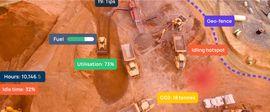
To provide a true representation of what is going on in a specific location, MachineMax uses a variety of APIs to show its customers the coordinates of where their off-road equipment is located, its condition, where it is in relation to other equipment in the field using geofences and to provide a visual picture with satellite imagery.

“With tools such as Heatmap Layer we can show, for example, excessive idling. This is where a vehicle or multiple vehicles are sitting with their engines on, burning fuel, emitting CO2, and being unproductive. And, we might even be able to show that this is happening because a load of dump trucks is backed up waiting to be loaded,” says Kate Stephen, Head of Product and Design at MachineMax.

Drilling into data tracked from mining and construction equipment 2

Getting data from remote areas

Although MachineMax implemented its Google Cloud and Google Maps solutions in-house, it wanted to further improve the accuracy of its GPS. Google suggested it call on the support of Google Cloud Premier Partner, Localyse to help it with this specific issue.

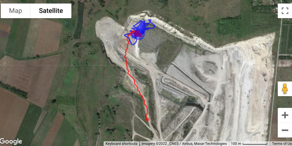
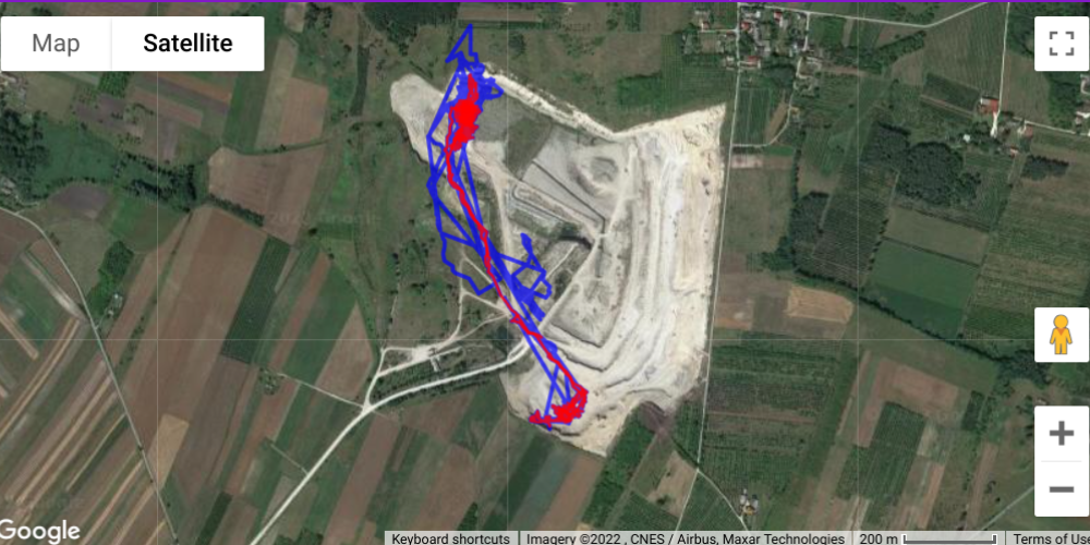
“We needed to try and increase the accuracy of our GPS, and there are several factors that can influence this, but the biggest factor is the number of satellites in view,” says Rizzo. “Localyse helped us to filter out all the GPS points that use a low number of satellites and also to use machine learning to reproduce a point from a previous point to help create a more accurate picture.”

Jennifer Thomson

Chief Growth Officer - MachineMax

“We know that with the support of Google Cloud and Google Maps, we can drill even deeper into the parameters of the data that we collect to help our customers become more profitable, more efficient, and more sustainable.”

Drilling into data tracked from mining and construction equipment 3

Let's discuss your project

Looking for a way to make better decisions about your business’s location-based strategies? Look no further than Localyse!

Email

Phone

🇳🇱 +31 (0)172 25 55 00 

Localyse optimizes expense management experience for Mobilexpense

Mobilexpense is a European tech group committed to simplifying expense management for multinationals and SME’s. Their software offers an all in one expense management solution. Furthermore, Mobilexpense has an impressive portfolio which consists of companies such as ABInBev and Promximus.

juist mob kopieren

Improving Mobilexpense’s software

Mobilexpense’s software is integrated in a wide range of travel providers. This allows for: 

Thanks to the use of location intelligence we were able to optimize Mobilexpense’s software. Now, the users’ experience when booking and expensing travel is even better. Localyse assisted Mobilexpense in integrating Google Maps’ API’s in its product portfolio, improving the legal mileage calculation process. Now, a more accurate overview can be consulted to view the legal mileage that needs to be reimbursed to employees.

Together with receipt data extraction, daily allowance calculations and direct links with credit card transactions, location intelligence integrations provide Mobilexpense with a reliable and easy-to-use expense management tool.

Location intelligence Integration

Together with receipt data extraction, daily allowance calculations and direct links with credit card transactions, location intelligence integrations provide Mobilexpense with a reliable and easy-to-use expense management tool.

Let's discuss your project

Looking for a way to make better decisions about your business’s location-based strategies? Look no further than Localyse!

Email

Phone

🇳🇱 +31 (0)172 25 55 00 

How Brussels used ODIQ as an alternative to traffic cameras

Brussels is the capital of Belgium and Europe. With 1.2 million inhabitants it counts as one of Belgium’s biggest cities. During the pandemic, Brussels used the reduced traffic in 2020 to accelerate their mobility plans. To follow up on the adjustments in real-time and historically, Brussels Mobility contacted Localyse.

logo NL

Localyse monitors all major access routes in Brussels

Mobiris, the dispatching center of Brussels Mobility, has about 500 cameras to monitor more than 350 km of roads in the Brussels-Capital Region, ‘one might think that’s plenty’ but in reality it’s far from enough. That’s why Mobiris, was looking for an addition/alternative to cameras. Localyse, introduced Brussels Mobility to ODIQ which uses Google Maps’ Floating Car Data, this is worldwide GPS data from smartphones on which Google Maps is installed… an inexhaustible, representative data source.

A versatile tool

ODIQ can be used for carrying out traffic analyses before a decision or intervention and after. Furthermore, the tool allows to detect bottlenecks intersection by intersection, and find out the reason for them: whether it is a wrongly adjusted traffic light, an illogical right of way or a bicycle lane that should be moved with ODIQ, it all becomes clear.

Brecht Debusschere

Traffic situation monitoring team lead

At trade fair we saw a presentation on ODIQ, and it seemed to be the ideal tool for gaining quick and easy insight into traffic situations by mapping traffic flow in real time.

Let's discuss your project

Looking for a way to make better decisions about your business’s location-based strategies? Look no further than Localyse!

Email

Phone

🇳🇱 +31 (0)172 25 55 00