
Earlier, we wrote an extensive article on how to optimize the ‘last mile’ with the latest Google Maps Geocoding API update. Today, we have great news for developers, logistics planners, and e-commerce companies in the Netherlands and across Europe: Google has just announced that the Geocoding API v4 is now officially in General Availability (GA)!
This release solves one of the biggest and most requested challenges in last-mile delivery and passenger transport: finding the exact right entrance of a building.
From a general address to specific entry points
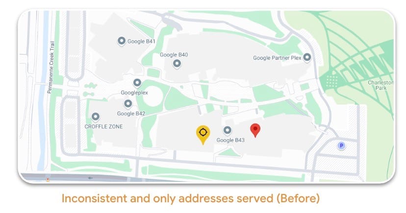
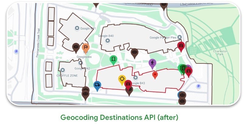
The images speak for themselves. Where the old API (see the ‘Before’ image) often resulted in one general, sometimes inconsistent pin on or near a large building complex, v4 changes this drastically.
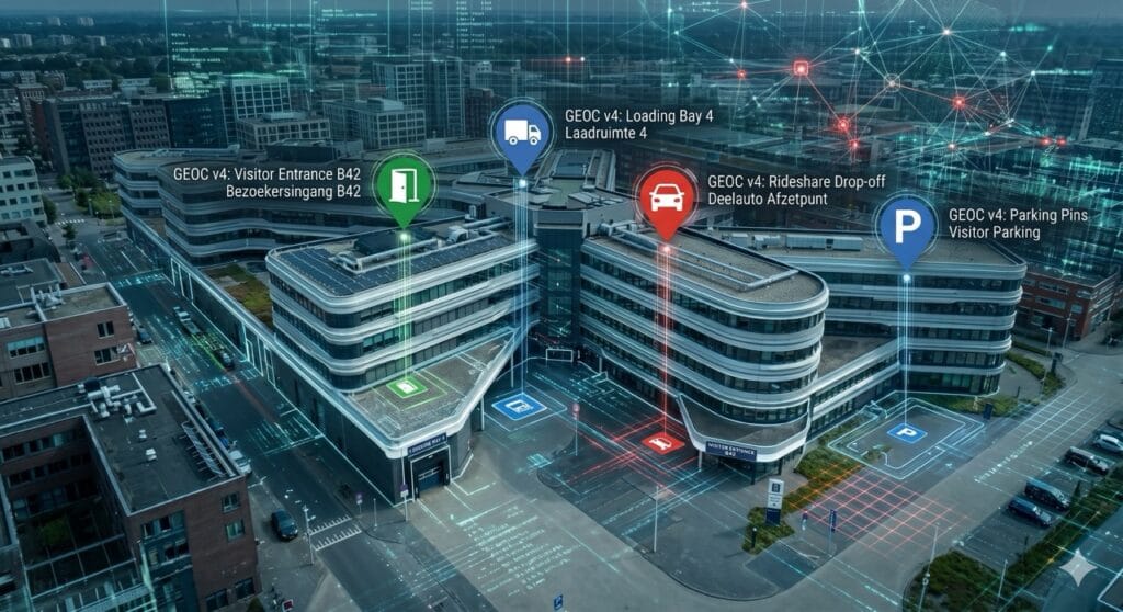
The new functionality, named Destinations, offers unprecedented hyperlocal details:
- Specific entry points: The API no longer just points to the building but recognizes specific entrances. Think of the main visitor entrance, the loading dock for trucks, or the parking garage entrance (clearly visible by the different icons in the ‘After’ image).
- Semantic descriptions: Besides coordinates, the API now provides contextual descriptions, such as: “the 2-story red building next to the bank”. This is indispensable for drivers searching on-site.
Under the hood: Faster and more secure infrastructure
Besides improved location data, Google has also completely revamped version 4 technically:
- Cloud-native infrastructure for maximum reliability and scalability.
- OAuth support for enhanced security.
- Field Masking, meaning you only request the data you actually need. This significantly optimizes performance and load times.
Why this is an absolute gamechanger
Thousands of early testers have already embraced Geocoding v4. Especially for the logistics sector, e-commerce players, and ride-hailing (like taxis and Uber), this delivers immediate results:
- Improved efficiency: Drivers no longer need to drive around a large building to find the loading dock. The route is calculated directly to the correct entry point, which significantly reduces delays.
- Fewer failed deliveries: Thanks to hyperlocal details, destinations are correctly identified and reached the first time.
- Higher user trust: Flawless delivery or a taxi waiting exactly at the right exit increases the reliability of your service and customer satisfaction.
Ready for the upgrade in your logistics operation?
Are you still using older geocoding methods in your application, TMS (Transport Management System), or e-commerce platform? Then now is the time to make the switch to v4 and make your last-mile operation in the Netherlands and wider Europe truly airtight.
Want to know how best to integrate this new Destinations functionality into your specific use case? Contact Localyse, your Google Maps Premier Partner. We serve clients throughout Europe and are happy to help you with a smooth and optimized transition!


