Google Premier Partner specialized in Location-Based Services.
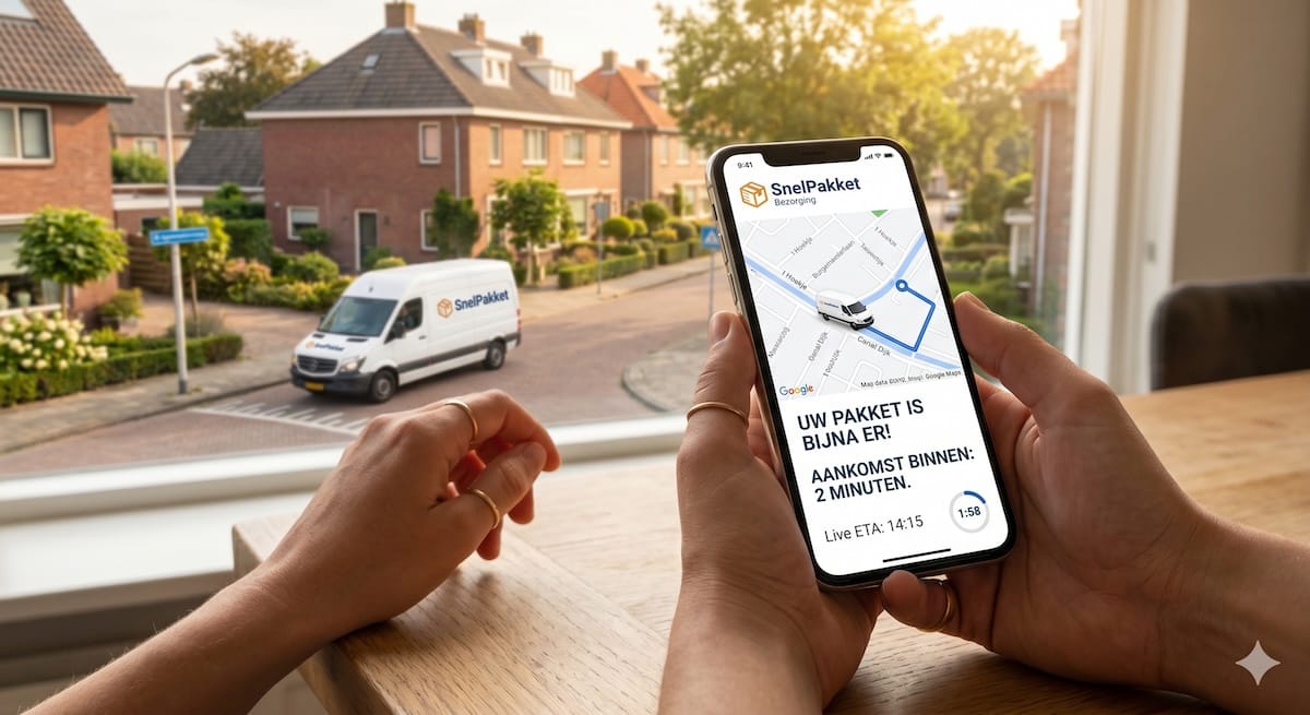
Help your users get from A to B with smart route optimization and add advanced navigation to your application, powered by extensive, real-time data.
Whether you want to streamline the logistics of an entire fleet in the Netherlands or build a seamless navigation experience in your own app: the Google Maps Routes APIs provide the intelligence you need. As the market-leading Google Maps Partner in the Netherlands, Localyse helps you integrate these powerful location tools seamlessly and cost-effectively into your business processes.
The Routes product suite from the Google Maps Platform consists of various smart APIs and SDKs specifically designed for every logistics and mobility challenge:
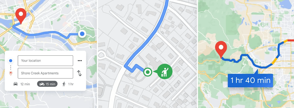
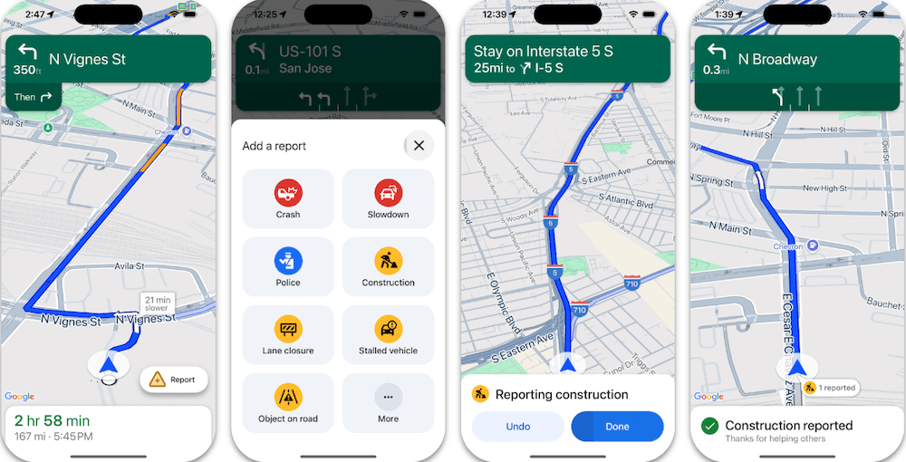
This is the bedrock of modern routing applications. Provide your users with highly accurate directions and estimated times of arrival (ETAs) based on real-time and historical traffic information.
Ideal for delivery services, taxi apps, and on-demand logistics. Calculate travel times and distances between dozens of origins and destinations in just a single API call.
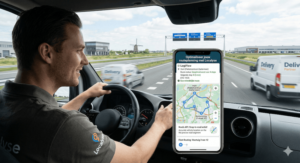

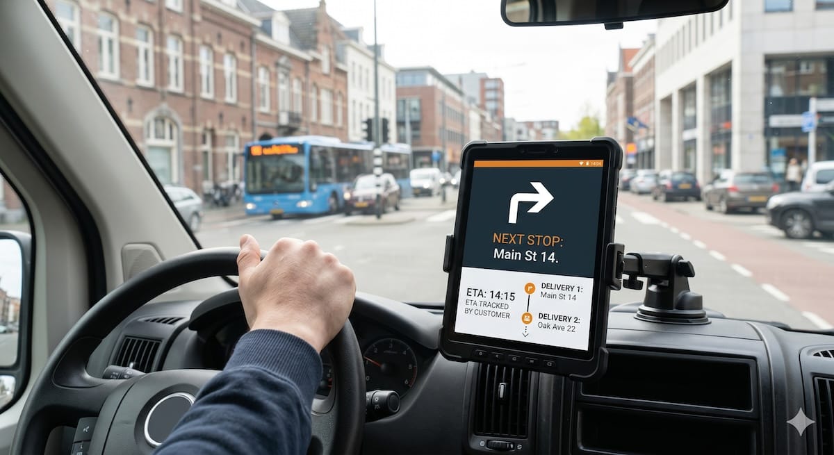
Maximize your delivery efficiency by intelligently planning routes with multiple stops.
Make raw GPS data perfectly workable and analyze traveled paths with the highest precision on the map.
Keep your users or drivers entirely within your own ecosystem. With a Navigation Request via the Navigation SDK, you integrate the familiar Google Maps turn-by-turn navigation directly into your own iOS or Android app.
As the leading Google Maps expert in the Benelux, we offer much more than just a license. We ensure your application performs optimally and is locally optimized.
Take your route planning, dispatching, and in-app navigation to the next level with reliable Google Maps data.
Your privacy settings
Manage Consent Preferences
Necessary
Analytics
Embedded Videos
Marketing
Facebook Advanced Matching
Facebook CAPI