Google Premier Partner specialized in Location-Based Services.
Large-scale infrastructure projects, such as the widening of the A2 highway between ’t Vonderen and Kerensheide, inevitably cause traffic disruptions and regional anxiety. Following a series of incidents on the highway, residents of the nearby hamlet of Graetheide voiced concerns about increasing cut-through traffic. Rather than relying on gut feelings or assumptions, the Municipality of Sittard-Geleen deployed Localyse’s ODIQ platform to monitor routing advice in real-time and uncover the hard facts.
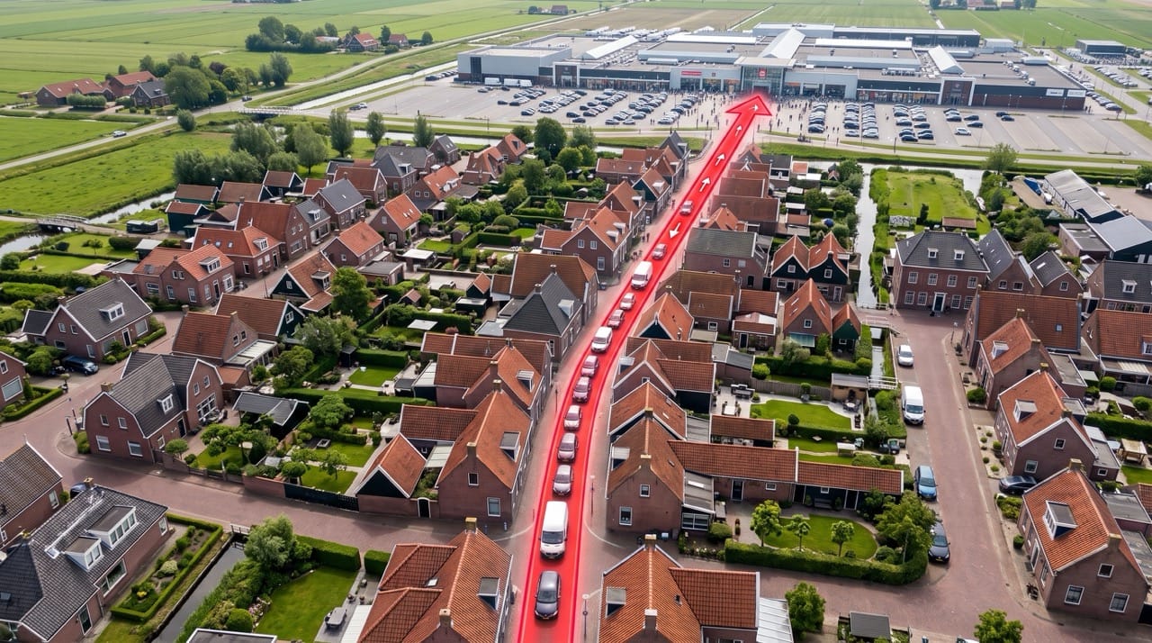
The hamlet of Graetheide runs parallel to the A2 highway. To protect local liveability, the municipality recently underwent a drastic physical redesign to transform the area into a traffic-calmed 30 km/h zone. The road was narrowed to 5.80 meters, on-street parking was introduced, and various speed humps and chicanes were installed.
However, when preparatory work on the A2 began and highway incidents increased, worried citizens quickly contacted the municipality, claiming the area was being flooded with cut-through traffic.
The immediate assumption in these scenarios is often that navigation apps like Google Maps are mass-routing drivers through local streets to avoid highway delays. But was that actually happening? How often, and at what times, was this specific route truly being recommended by Google Maps? To implement effective policies and communicate clearly with residents, the municipality needed objective traffic monitoring.
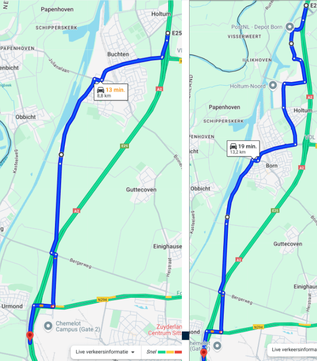
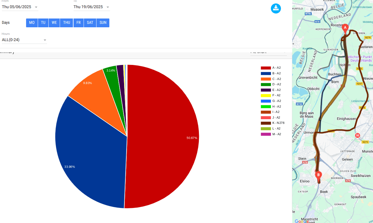
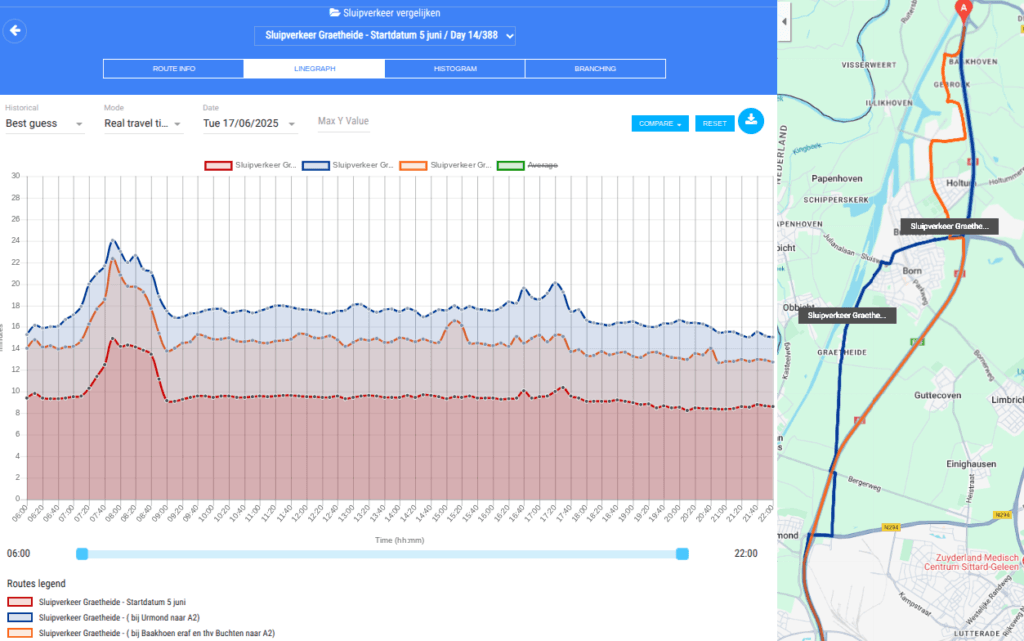
Sittard-Geleen partnered with Localyse to put these assumptions to the test. Using the ODIQ data platform, they set up a targeted travel-time and routing analysis:
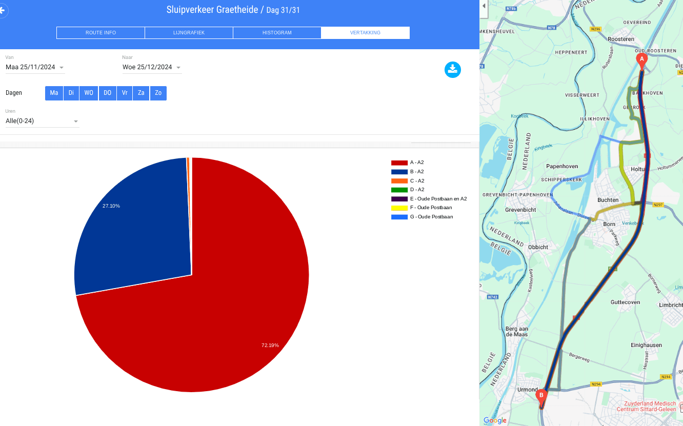
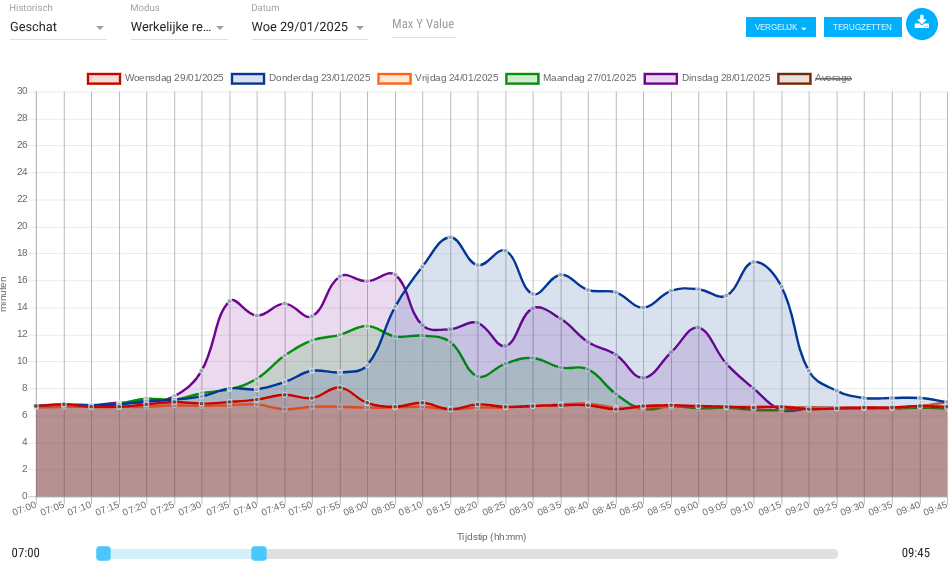
The results from the ODIQ analysis provided the municipality with a surprising, yet highly valuable insight: In reality, Google Maps rarely recommended the shortcut through Graetheide. Even at peak times when delays on the A2 spiked due to accidents, Google Maps’ algorithm kept drivers on the main highway.
This led to a crucial conclusion for local mobility policy: the traffic filtering through the village during busy periods did not consist of masses of ‘digitally routed’ strangers, but rather local commuters who simply knew the area well and left the highway on their own initiative.
By leveraging the ODIQ platform, the Municipality of Sittard-Geleen achieved key objectives:
Want to know if navigation apps are truly driving cut-through traffic through your municipality? Test your assumptions, measure the facts with ODIQ, and contact Localyse today for a targeted routing analysis.
Your privacy settings
Manage Consent Preferences
Necessary
Analytics
Embedded Videos
Marketing
Facebook Advanced Matching
Facebook CAPI