Google Premier Partner specialized in Location-Based Services.
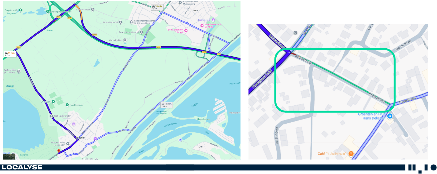
The Municipality of Maasgouw, and specifically the small village of Beegden, struggled with a persistent traffic problem. Located near the village is the Designer Outlet Roermond, a massive attraction drawing around 6 million visitors annually.
As soon as the main roads to the outlet became congested, the algorithms of navigation apps like Google Maps immediately searched for the fastest alternative route. The result? A massive volume of through traffic was routed straight through the narrow Dorpstraat and Kruisstraat in Beegden. These streets are designed purely for local traffic and are absolutely not equipped to handle thousands of bargain hunters. This led to dangerous situations, nuisance for residents, and a desperate search for a solution.
Bram Teeuwen, policy advisor at the Municipality of Maasgouw, reached out to Localyse: “Do you see any possibilities to digitally intervene in the traffic driven by navigation systems?”
In the market and the media, there is a common perception that road authorities are powerless against the smart algorithms of tech giants. On the other hand, some software vendors promise that the problem can be solved with a single ‘magic checkbox’ or a simple software tool.
Neither is true. An algorithm cannot be easily tamed by a superficial roadblock, but as a municipality, you are certainly not powerless. The key word is data context.
As a Google Maps Platform Premier Partner, we don’t look for quick band-aids; we look at the foundation of the map data.
We thoroughly analyzed the Beegden case and directly engaged with Google. In doing so, we provided the essential, local context that the algorithm couldn’t ‘see’ on its own: the Kruisstraat is physically a narrow residential street, unsuitable for massive through traffic heading to the outlet. By enriching the data at the back-end of the map with the correct geographical and infrastructural context, you speak the language the algorithm actually understands.
Our honest philosophy: If a cut-through route in a municipality is legally and physically a suitable, public road for through traffic, a navigation app will continue to use it. Digital traffic management is about accurate data, not wishful thinking or forcing incorrect blockades.
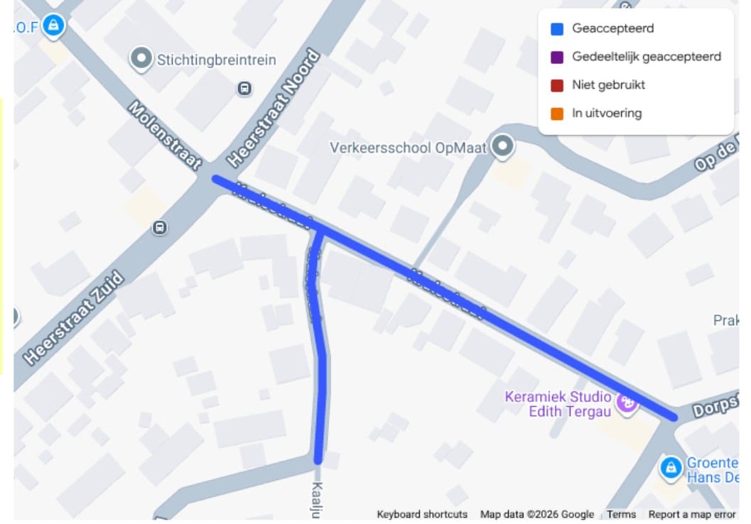
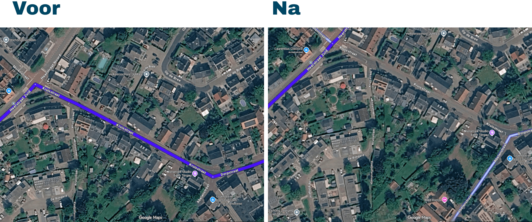
The intervention was successful. Google accepted Localyse’s data feedback and processed it within the platform. The Kruisstraat has been structurally removed as a suggested shortcut for through traffic heading to the outlet.
For the residents of Beegden, this means a direct improvement in livability and traffic safety. For the Municipality of Maasgouw, it is hard proof that, provided you have the right expertise, you can indeed take control of your digital road network.
Don’t stand by powerlessly while navigation apps dictate the traffic in your municipality. Let’s explore together what is truly digitally possible for your biggest headache (and what isn’t).
Your privacy settings
Manage Consent Preferences
Necessary
Analytics
Embedded Videos
Marketing
Facebook Advanced Matching
Facebook CAPI